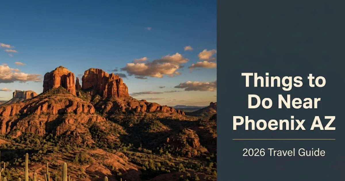
Things to Do Near Phoenix, AZ: Best Activities in 2026

The best things to do near Phoenix, AZ stretch across an extraordinary range of terrain, from Sedona’s red canyon walls to the Grand Canyon’s South Rim.
Within a three-hour drive of Phoenix Sky Harbor, travelers access desert hiking, historic mining towns, and one of the country’s most distinct wine regions.
This guide covers specific named destinations, honest drive-time expectations, booking requirements, and which experiences suit which traveler type.
Things to Do Near Phoenix AZ: Understanding the Region
The Phoenix area functions as one of the United States’ most productive road-trip base camps.
The city sits at the center of a 200-mile radius that includes four completely distinct landscape types: Sonoran Desert floor, red rock canyon country, high-elevation ponderosa pine forests, and the Colorado Plateau.
The Greater Phoenix Convention and Visitors Bureau identifies more than 300 days of sunshine annually in the metro area. That statistic matters most in spring and fall.
Summer is genuinely different. Temperatures regularly exceed 110°F in the valley from June through August.
High-elevation destinations like Flagstaff (6,900 feet) and Prescott (5,400 feet) stay 20 to 30°F cooler. That temperature gap defines summer trip planning.
Insider Tip:
- Most visitors underestimate the size of the region. Antelope Canyon is 4.5 hours from Phoenix, not a casual day trip.
- The Apache Trail loop and Sedona are the two experiences that genuinely fit a single Phoenix-based day trip.
- Solo travelers and couples benefit most from the region’s self-drive structure; families with young children need to factor in longer drive tolerances.
Day Trips From Phoenix: The Core Options
Day trips from Phoenix cover five distinct zones, each offering a different landscape and experience type.
| Destination | Drive Time from PHX | Best For | Cost Tier | Best Season |
|---|---|---|---|---|
| Sedona | 2 hours | Couples, hikers, first-timers | Mid to premium | Oct to May |
| Grand Canyon South Rim | 3.5 to 4 hours | All profiles | $35/vehicle entry | Apr to Oct, avoid July/Aug heat |
| Prescott | 1.5 hours | Seniors, couples, history lovers | Budget to mid | Year-round |
| Jerome | 1.75 hours | Couples, history lovers | Budget | Oct to May |
| Apache Trail | 1 hour start | Hikers, photographers, adventurers | Low to budget | Oct to Apr |
| Flagstaff | 2.5 hours | Families, outdoor enthusiasts | Budget to mid | Year-round |
| Verde Valley / Cottonwood | 1.75 hours | Wine lovers, couples | Mid | Oct to May |
For first-time visitors, Sedona is the single clearest answer to the question of what to do near Phoenix.
It offers the highest density of iconic experiences per mile of any destination in the region.
Profile note for families: Prescott and Flagstaff are significantly more family-friendly for younger children than Sedona’s trail-heavy terrain.
Outdoor Activities Near Phoenix AZ
Outdoor activities near Phoenix, AZ range from beginner desert walks to technical canyon hikes, with conditions that vary sharply by season.
South Mountain Park, the largest municipal park in the United States by land area, sits within the Phoenix city limits at approximately 16,500 acres.
Its National Trail covers 14.7 miles of rugged desert ridgeline. The Pima Canyon Trail within South Mountain offers an easier entry point for first-time desert hikers.
McDowell Sonoran Preserve in Scottsdale provides access to the Brown’s Ranch Trailhead, a network of 225 miles of trails through classic Sonoran Desert terrain.
Brown’s Ranch suits beginners through intermediate hikers. Summer access requires a very early start: on trail before 6 AM from May through September.
Profile note for seniors: The Desert Botanical Garden’s paved loop trails provide accessible desert ecology without demanding terrain. The garden sits within Papago Park, approximately 10 minutes from central Phoenix.
Insider Tip:
- Camelback Mountain’s Echo Canyon Trail is Phoenix’s most famous hike. It is also among its most physically demanding: 1.5 miles one way with significant scrambling over boulders.
- The Cholla Trail on the Camelback east face is longer but less technical. It suits confident hikers who want the summit without the Echo Canyon crowds.
- Timed-entry parking reservations are required for Echo Canyon. Book through the City of Phoenix Parks system; verify availability before visiting.
Hiking Near Phoenix AZ
The best hiking near Phoenix, AZ sits within a 90-minute radius and spans six distinct trail environments.
Lost Dutchman State Park, 40 miles east of Phoenix on US Route 60, is the gateway to the Superstition Mountains.
The Siphon Draw Trail to the Flatiron summit is the park’s signature hike: 5.4 miles round-trip with 2,800 feet of elevation gain. It is not a casual outing.
For beginners, the Treasure Loop Trail at Lost Dutchman (2.4 miles, moderate) delivers classic Superstition Mountain scenery without technical terrain.
Tonto Natural Bridge State Park, about 100 miles northeast of Phoenix via State Route 87, contains what the National Park Service identifies as the world’s largest natural travertine bridge.
The main viewing trail is short (0.5 miles) but steep. The base of the bridge can be reached via a rocky scramble that is unsuitable for small children or travelers with limited mobility.
Profile note for budget travelers: Lost Dutchman State Park and South Mountain Park offer full-day hiking experiences with minimal entry fees. Verify current day-use fees with Arizona State Parks before visiting.
Key safety facts for desert hiking near Phoenix:
- Carry a minimum of one gallon of water per person per day of desert hiking
- Begin all summer hikes before 7 AM; be off exposed ridgelines before 10 AM
- Cell service is limited in the Superstition Mountains and Tonto National Forest
- Bold warning: Never hike in the Superstitions or South Mountain above 80°F without prior desert hiking experience and excess water capacity
Key Takeaway: Lost Dutchman State Park and the Superstition Mountains deliver the most rewarding hiking experience within 90 minutes of Phoenix. Start early, carry excess water, and verify trailhead access with Arizona State Parks.
Sedona Day Trip From Phoenix
A Sedona day trip from Phoenix is the single highest-return one-day experience available within a two-hour drive of the city.
Sedona sits 116 miles north of Phoenix via Interstate 17 and State Route 179. The drive takes approximately two hours under normal traffic conditions.
Cathedral Rock is Sedona’s most-photographed landmark. The trailhead sits on Back O’ Beyond Road, off State Route 179.
The hike to the saddle overlook is 1.5 miles round-trip with significant boulder scrambling at the end. It earns its reputation.
Devil’s Bridge is the area’s most dramatic single-feature hike. The 4-mile round-trip trail leads to a natural sandstone arch spanning approximately 54 feet.
Devil’s Bridge requires advance parking reservations through Red Rock Pass. The trailhead lot fills before 8 AM on weekends from October through May.
The overrated pick: Tlaquepaque Arts and Shopping Village is attractive, but its gift shop nature disappoints visitors who expect a genuine arts market. The galleries along Hillside Sedona on State Route 179 show more serious work from local artists.
Slide Rock State Park in Oak Creek Canyon, 7 miles north of Sedona on State Route 89A, is the local alternative for families.
Natural water slides carved into red rock creek beds provide hours of activity for children and adults. Timed-entry tickets are required; book in advance through Arizona State Parks.
Profile note for couples: The Airport Mesa Vortex viewpoint, accessible via a 10-minute walk from Airport Road, provides 360-degree views of Sedona’s red rock formations at sunrise. Crowds are thinner before 8 AM.
Grand Canyon From Phoenix
The Grand Canyon South Rim is approximately 228 miles from Phoenix, a 3.5 to 4-hour drive via Interstate 17 north and US Route 180.
It is the most ambitious single-day option from Phoenix. Most experienced visitors recommend at least one overnight stay at or near Grand Canyon Village.
Grand Canyon Village is the South Rim’s primary hub. The Rim Trail, a paved path running 13 miles along the canyon edge, is the most accessible way to experience the canyon’s scale.
Desert View Drive, the 25-mile scenic road running east from Grand Canyon Village to Desert View Watchtower, is the South Rim’s most underused asset.
Most visitors cluster at Mather Point and Yavapai Observation Station. Desert View Watchtower, at the road’s eastern end, provides equally dramatic views with a fraction of the foot traffic.
The Bright Angel Trail descends from the South Rim into the canyon. Day hikers should not attempt to reach the Colorado River and return in one day. The National Park Service explicitly warns against this attempt.
The 3-mile-round-trip descent to the Indian Garden (Havasupai Garden) area is the recommended day-hike limit for most visitors.
Profile note for seniors and accessibility travelers: The South Rim Visitor Center and Mather Point area are paved and accessible via the free Grand Canyon Shuttle System. The park’s accessible parking and route network make the South Rim one of the most mobility-friendly national park experiences in the Southwest.
Insider Tip:
- Grand Canyon Village accommodation books out months in advance for spring and fall. Tusayan (7 miles south of the park) offers an alternative overnight base.
- Entering the park requires a vehicle reservation on peak days (May through September, weekends). Book through Recreation.gov.
- The North Rim is closed from mid-October through mid-May; verify dates with the National Park Service before planning a North Rim visit.
Jerome and Prescott From Phoenix
Jerome and Prescott together form the region’s most rewarding history and character combination within a 2-hour drive of Phoenix.
Jerome sits at 5,000 feet elevation on Mingus Mountain, 100 miles north of Phoenix via Interstate 17 and State Route 89A.
It was one of the largest copper mining towns in the United States. Today its steep hillside streets contain galleries, wine bars, small boutiques, and one genuinely good restaurant in The Asylum at the Jerome Grand Hotel.
Jerome’s overrated experience: the ghost tours. Its underrated experience: the Gold King Mine and Ghost Town on the outskirts, an authentic collection of vintage mining equipment and vehicles that captures the industrial reality of the mining era without theatrical staging.
Prescott, 30 miles southwest of Jerome via State Route 89A, anchors the high-desert cool-climate corridor.
Prescott Whiskey Row on Montezuma Street is the city’s most photographed block. It’s a legitimate draw: historic saloons, good craft beer, and a walkable central plaza that functions as a genuine community gathering point, not just a tourist strip.
Watson Lake, three miles north of Prescott on Watson Lake Road, is the area’s local alternative for outdoor experience. The granite boulders rising from the lake’s edge at the Granite Dells make it one of the most visually distinctive lake landscapes in the Southwest.
Profile note for budget travelers: Prescott’s central plaza and Watson Lake are free to access. Jerome’s galleries and streets require no admission. A Jerome-Prescott loop from Phoenix makes for a full-day road trip with minimal expenditure beyond fuel and a lunch stop.
Key Takeaway: The Jerome-Prescott loop is the region’s most underappreciated day trip. Jerome’s history and Prescott’s Granite Dells deliver genuine character that Sedona’s more commercialized trail circuit cannot match.
Apache Trail Scenic Drive
The Apache Trail (State Route 88) is the most geologically dramatic short road trip accessible from Phoenix, beginning 35 miles east of the city.
The 40-mile route passes through the Superstition Wilderness, skirts three lakes, and climbs to a series of viewpoints above the Salt River chain of lakes.
Canyon Lake, 15 miles into the route from the Tortilla Flat direction, offers kayak rentals, a steamboat cruise on Canyon Lake itself, and a swimming area. It’s the clearest entry point for families.
Tortilla Flat, a small settlement at roughly the route’s midpoint, is genuinely one of the most idiosyncratic roadside stops in Arizona. Population: 6. One restaurant. One bar. A gift shop. Wall-to-wall dollar bills stapled by previous visitors. It earns a 30-minute stop.
The road becomes unpaved east of Tortilla Flat. The 22-mile dirt section through Fish Creek Hill descends through a series of switchbacks with sheer drop-offs and no guardrails on certain sections.
This segment is not recommended for low-clearance vehicles, rental cars (check your agreement), or drivers uncomfortable on narrow mountain roads.
Goldfield Ghost Town, just outside the Apache Trail’s western entrance near Superstition Mountain, works as an add-on for families. Mine tours run approximately every 30 minutes. The narrow-gauge railroad loop is popular with children under 12.
Profile note for seniors: Canyon Lake’s steamboat cruise is the most accessible Apache Trail experience. The boat provides full views of the lake canyon without any trail requirement. Verify operating schedules directly with the Canyon Lake Marina before visiting.
Scottsdale and Tempe Near Phoenix
Scottsdale and Tempe are the two communities within the Phoenix metro that most reward spending a dedicated day rather than treating them as quick stops.
Old Town Scottsdale is the city’s most walkable district. The gallery district along Main Street and Marshall Way represents genuine contemporary Western art, not souvenir shops.
Taliesin West, Frank Lloyd Wright’s winter home and architectural school on Frank Lloyd Wright Boulevard in north Scottsdale, is one of the most architecturally significant sites in the American Southwest.
Guided tours run approximately 60 to 90 minutes. According to the Frank Lloyd Wright Foundation, Taliesin West is the only active school of architecture operating from one of Wright’s original built works. Verify tour times and admission ranges before visiting.
The Musical Instrument Museum on East Mayo Boulevard in north Scottsdale consistently receives recognition from major travel publications as one of the most engaging museum experiences in the Phoenix metro.
It houses instruments and performance recordings from every country in the world. The audio technology that lets visitors hear each instrument as they approach its display case makes it unlike any standard museum exhibit.
Tempe Town Lake, in the heart of Tempe adjacent to Arizona State University, provides kayaking, paddleboarding, and walking paths along the Salt River channel. It’s free to access and functions as the metro’s best urban waterfront.
Profile note for solo travelers: Tempe’s Mill Avenue corridor and the ASU Tempe campus area have a genuinely active social scene from Thursday through Saturday evenings. The area suits solo travelers who want urban energy without Scottsdale’s resort price point.
Key Takeaway: Taliesin West is the Phoenix metro’s single most intellectually rewarding attraction. Book your tour in advance. It takes two hours and genuinely earns every minute.
Salt River and Water Activities Near Phoenix
Salt River tubing is the Phoenix area’s most distinctively local summer outdoor experience, and it operates specifically because of the region’s extreme summer heat.
Salt River Recreation manages tubing access on the Lower Salt River, approximately 30 miles northeast of Phoenix near Mesa and Fountain Hills.
The float covers approximately 4 miles of calm river through saguaro cactus-lined canyon walls. It takes 2 to 4 hours depending on water flow. Transport back to the launch point is included in the tube rental fee.
Tubing season typically runs from April through September. Peak summer months see the highest crowds and longest shuttle lines.
Saguaro Lake, accessible from the Bush Highway north of Mesa, offers kayaking, jet skiing, and boat rentals on a lake that sits entirely within the Tonto National Forest.
The lake’s saguaro-lined red-rock shoreline is photographically striking and far less visited than Tempe Town Lake. Boat and kayak rentals are available through Saguaro Lake Marina; verify seasonal availability before visiting.
Profile note for families: Salt River tubing has a minimum age and height requirement set by Salt River Recreation. Children under 8 and under a specific height are generally not permitted. Check current requirements directly with Salt River Recreation before bringing young children.
The honest note: Salt River tubing is crowded from mid-June through August. Bring a waterproof bag, sunscreen, and water shoes. Sunburn on the river is a genuine risk. The float feels leisurely but the Arizona sun at midday is not.
Verde Valley Wine Country
The Verde Valley Wine Consortium identifies this region as Arizona’s most productive wine appellation, a fact that surprises most visitors who do not associate Arizona with viticulture.
Old Town Cottonwood, 90 miles north of Phoenix via Interstate 17 and State Route 260, is the Verde Valley’s most walkable wine district.
Page Springs Cellars, on Page Springs Road outside Cornville (10 miles from Cottonwood), is considered by many Arizona wine writers to be the state’s most serious wineyard. Its Rhône-style reds use Arizona-grown grapes and have earned coverage in national wine publications.
Caduceus Cellars in Old Town Jerome, operated by musician Maynard James Keenan, draws visitors from outside the wine community. It produces limited Arizona estate wines; the tasting room has irregular hours and often sells out on weekends. Call ahead.
The Verde Canyon Railroad in Clarkdale offers a four-hour round-trip excursion through the Verde River canyon. The route passes through a wilderness canyon inaccessible by road.
The railroad runs seasonally with limited winter service. This is the single clearest activity recommendation for senior travelers or any visitor who wants Verde Valley scenery without hiking.
Profile note for couples: A Cottonwood wine district afternoon followed by dinner in Jerome makes for a highly effective romantic day trip. The Jerome Grand Hotel’s dining room, The Asylum, serves reliably good food with canyon views from 5,200 feet elevation.
Antelope Canyon and Horseshoe Bend
Antelope Canyon and Horseshoe Bend are both located near Page, Arizona, approximately 270 miles from Phoenix and 4.5 to 5 hours by car.
These are not day trips. Treating them as a casual Phoenix day trip is the single most common planning mistake visitors make in this region.
Antelope Canyon requires a guided tour booked through authorized Navajo Nation tour operators. Tours typically run 45 to 90 minutes and fill weeks in advance during spring and fall.
Lower Antelope Canyon (Antelope Canyon X), also in Page, operates with multiple authorized tour companies at slightly lower price points than Upper Antelope Canyon. Both require advance booking.
Horseshoe Bend is a free-access viewpoint managed by the Bureau of Land Management, 5 miles south of Page off US Route 89. The 0.9-mile walk to the overlook is exposed, with no shade and significant sun exposure.
Visit Horseshoe Bend before 8 AM or after 4 PM to avoid midday sun and peak crowds. The overlook has no railing on significant sections of the sandstone edge.
Profile note for all travelers: Horseshoe Bend’s sandstone edge has resulted in fatal falls. Stay on designated viewpoint areas. The drop is approximately 1,000 feet. This is not a warning to be skimmed.
Most visitors combine Antelope Canyon and Horseshoe Bend with a Lake Powell stop and one overnight in Page. Treat this as a two-day trip from Phoenix, not a day trip.
Key Takeaway: Antelope Canyon requires advance booking through authorized Navajo Nation tour operators. Walk-up access is not available. Book weeks or months ahead, especially for spring and fall travel.
Kid-Friendly Day Trips From Phoenix
The best kid-friendly day trips from Phoenix combine manageable drive times with activities that hold children’s attention beyond the first 20 minutes.
Top family options, ranked by kid engagement level:
- Desert Botanical Garden (Phoenix): 55 acres of Sonoran Desert plants with a children’s Explorer Path. The evening Luminaria event in December adds fairy-tale atmosphere for families with young children. Admission runs in the mid-range per adult; verify current rates.
- Goldfield Ghost Town (Apache Junction): Mine tours, a narrow-gauge railroad, and a reptile exhibit. Genuinely holds children’s attention for two to three hours.
- Canyon Lake (Apache Trail): The steamboat cruise and sandy swim beach work for children aged 5 and older. Bring shade gear; the lake sits in an exposed canyon with minimal natural shade.
- Slide Rock State Park (Oak Creek Canyon, Sedona corridor): Natural water slides work best for children aged 8 and older. The current and rock surfaces require swimming confidence.
- Out of Africa Wildlife Park (Camp Verde, 90 miles north): A private wildlife park featuring tiger shows, giraffe feeding, and a safari experience. It is unambiguously commercial but consistently rated by families as one of the most genuinely engaging wildlife experiences for children under 12 in Arizona.
Profile note: Families with children under 5 are best served by the Desert Botanical Garden and Goldfield Ghost Town. Both have paved or manageable paths, shade areas, and manageable durations.
Romantic Getaways Near Phoenix AZ
Romantic getaways near Phoenix, AZ benefit from a region that has both spectacular natural scenery and a resort infrastructure built around couples travel.
Sedona remains the clearest romantic answer in the region. The combination of dramatic red rock backdrops, high-end spa resorts, and intimate restaurant settings is difficult to replicate elsewhere in the Southwest.
L’Auberge de Sedona on L’Auberge Lane sits directly on Oak Creek. It consistently appears in Travel + Leisure and Conde Nast Traveler rankings for Arizona romantic properties. Rates reflect that positioning; plan accordingly.
The Airport Mesa Vortex sunrise walk (free, 15-minute walk from the Airport Road trailhead) is one of Sedona’s most genuinely romantic low-cost experiences. It requires an early alarm and zero reservation.
Prescott’s Courthouse Plaza on a cool October evening, with dinner on Whiskey Row and a weekend stay at one of the historic downtown hotels, is the region’s best romantic alternative to Sedona at a significantly lower price point.
For couples who want a full resort experience without leaving the metro, Scottsdale’s resort corridor along North Scottsdale Road delivers: multiple spa resorts, rooftop bars, and the walkable restaurant scene of Old Town within 20 minutes.
Profile note: Couples visiting between October and April get the full Sedona experience. Summer in Sedona is hotter than most visitors expect at 4,350 feet elevation. July and August temperatures regularly exceed 95°F, which reshapes the romantic appeal of its outdoor attractions significantly.
Best Time to Visit Near Phoenix AZ
The best time to visit near Phoenix, AZ is October through April, with March and April offering the ideal combination of wildflower blooms, comfortable temperatures, and full trail access.
| Month | Temp (Phoenix) | Conditions | Crowd Level | Recommended? |
|---|---|---|---|---|
| October to November | 75°F to 90°F | Ideal | Moderate | Yes |
| December to January | 60°F to 72°F | Excellent | Low | Yes |
| February to March | 65°F to 80°F | Peak wildflower season | High | Yes |
| April | 80°F to 90°F | Excellent | High | Yes |
| May | 90°F to 100°F | Warming; start early | Moderate | Cautiously |
| June to August | 105°F to 115°F+ | Dangerous for outdoor activity | Low | No (valley); High-elevation only |
| September | 95°F to 105°F | Monsoon risk; cooling late month | Low | Cautiously |
February through early March is the desert wildflower bloom season. Saguaro blooms peak in May. The Arizona Office of Tourism tracks wildflower reports annually; check their wildflower alert page before a spring trip.
July through August is Arizona’s monsoon season. Afternoon thunderstorms bring dramatic desert skies and flash flood risk in slot canyons and desert washes.
Profile note for budget travelers: December through January offers the region’s lowest hotel rates in Scottsdale and Sedona. Temperatures are genuinely pleasant for hiking. This is the region’s best-kept seasonal value window.
Practical Logistics for Day Trips From Phoenix
Getting the logistics right for day trips from Phoenix requires a personal vehicle, advance planning for permit-required experiences, and a clear understanding of drive times.
Getting around:
- Rent a vehicle from Phoenix Sky Harbor Airport (PHX). All major rental companies operate on-site. Reserve early for weekend travel and holiday periods.
- Plan route timing using Google Maps with real departure time inputs. Interstate 17 north toward Sedona and Flagstaff experiences significant weekend congestion northbound Friday afternoon and southbound Sunday afternoon.
- Download offline maps before departing for Apache Trail, Tonto National Forest, and Superstition Mountain areas. Cell service drops significantly off major highways.
- For Grand Canyon, Horseshoe Bend, and peak-season Sedona, research timed-entry or parking reservation requirements before departure. Systems change annually.
- Carry physical cash for smaller destinations: Tortilla Flat, certain state park day-use kiosks, and remote trailhead areas may not reliably accept cards.
What to prepare before leaving Phoenix:
- Water: minimum one gallon per person per day for any desert activity
- Sunscreen SPF 50 or higher; reapply every 90 minutes outdoors
- Layers for high-elevation destinations: Flagstaff and Prescott can be 30°F cooler than Phoenix in winter
- Red Rock Pass or America the Beautiful National Parks Pass for frequent visitors to federal recreation areas
Profile note for solo travelers: Solo travelers in the Superstition Mountains and Apache Trail corridor should inform someone of their planned route and expected return time. These areas have genuine search-and-rescue call volumes from under-prepared visitors.
Key Takeaway: Book Antelope Canyon tours, Grand Canyon vehicle permits, and Slide Rock State Park timed-entry tickets before you arrive in Phoenix. Walk-up access for all three is unreliable in peak season.
Safety and Practical Warnings for the Phoenix Region
The primary risk for outdoor activity near Phoenix is extreme heat, which is genuinely dangerous and responsible for multiple deaths among visitors each year.
Key safety facts every visitor should know:
- Heat: Never begin a desert hike after 9 AM from June through August. Phoenix City Parks and the Maricopa County Sheriff’s Office both issue heat-related rescue warnings when temperatures exceed 100°F.
- Water: Carry one gallon of water per person per desert outing. Thirst is not an early indicator of heat exhaustion. Drink before you feel thirsty.
- Flash floods: Do not enter slot canyons or desert washes during monsoon season (July through September) if there is any thunderstorm activity within 50 miles. Flash floods travel faster than a person can run. Antelope Canyon has had fatal flash flood incidents.
- Snakes and wildlife: Rattlesnakes are active on desert trails from spring through fall. Watch where you step and where you place your hands on rocks. Give all wildlife a minimum of 6 feet of space.
- Sun exposure: Horseshoe Bend’s overlook, Lake Powell, and all open-water locations amplify sun exposure. Carry shade gear and high-SPF sun protection.
- Road conditions: The unpaved section of the Apache Trail (State Route 88) east of Tortilla Flat is a one-lane mountain road with blind curves. Exercise caution. Rental vehicle agreements may prohibit use on unpaved roads; check yours before driving this section.
In case of a hiking emergency in Maricopa County, contact the Maricopa County Sheriff’s Office Search and Rescue at 602-876-1011, or call 911 for life-threatening emergencies.
A Suggested Weekend Itinerary Near Phoenix
Day 1: Sedona and Oak Creek Canyon
- Depart Phoenix by 6:30 AM via Interstate 17 north.
- Arrive Sedona by 8:30 AM. Park at the Cathedral Rock trailhead on Back O’ Beyond Road.
- Hike Cathedral Rock saddle (1.5 miles round-trip, 45 to 75 minutes).
- Drive State Route 179 north through Sedona. Stop at Hillside Sedona galleries if open.
- Drive 7 miles north on State Route 89A into Oak Creek Canyon.
- Visit Slide Rock State Park (timed-entry ticket required; book in advance).
- Return south through Sedona. Dinner in Uptown Sedona.
- Overnight in Sedona or drive back to Phoenix (2 hours).
Day 2: Apache Trail and Superstition Mountains
- Depart Phoenix or Sedona by 7:30 AM.
- Take US Route 60 east to Apache Junction.
- Stop at Goldfield Ghost Town (opens typically at 9 AM; verify before visiting).
- Drive the paved section of Apache Trail (State Route 88) to Canyon Lake (20 miles).
- Optional: Take the Canyon Lake steamboat cruise (approximately 90 minutes; reservations recommended).
- Continue to Tortilla Flat for lunch at the country store restaurant.
- Return via the paved route back to Apache Junction and Phoenix.
Frequently Asked Questions About Things to Do Near Phoenix AZ
What are the best day trips from Phoenix, Arizona?
The best day trips from Phoenix are Sedona (2 hours), Prescott (1.5 hours), Jerome (1.75 hours), and the Apache Trail (45 minutes to the trailhead start).
The Grand Canyon South Rim is a 3.5 to 4-hour drive and works best as an overnight trip rather than a single-day push from Phoenix.
Antelope Canyon and Horseshoe Bend near Page, Arizona, are 4.5 to 5 hours from Phoenix and require at least one overnight stay to be worth the drive.
How far is Sedona from Phoenix and is it worth the drive?
Sedona is approximately 116 miles from Phoenix, a 2-hour drive via Interstate 17 north and State Route 179.
For first-time visitors to the Phoenix area, Sedona is the clearest single-day destination: red rock hiking, scenic canyon drives, and a walkable town center within a manageable drive.
Repeat visitors who have already done Sedona’s main trails should consider the Jerome-Prescott loop or Verde Valley wine country as higher-value alternatives on a second trip.
What is the best time of year to visit the Phoenix area for outdoor activities?
The best time to visit near Phoenix for outdoor activities is October through April, with February through early April offering ideal temperatures and desert wildflower blooms.
Summer (June through August) brings temperatures regularly above 110°F in the Phoenix valley, making outdoor activity genuinely dangerous without extreme heat preparation.
High-elevation destinations like Flagstaff (6,900 feet) and Prescott (5,400 feet) remain viable year-round and stay 20 to 30°F cooler than Phoenix in summer months.
Do I need to book Antelope Canyon in advance from Phoenix?
Yes. Antelope Canyon requires advance booking through authorized Navajo Nation tour operators, and walk-up access is not available.
Tours for Upper Antelope Canyon and Lower Antelope Canyon (Antelope Canyon X) typically sell out weeks or months in advance during spring and fall peak seasons.
Book as early as possible through the authorized operators listed on the Navajo Nation Parks and Recreation website; do not rely on third-party resellers.
What can families with kids do near Phoenix, Arizona?
The best family-friendly options near Phoenix include the Desert Botanical Garden in Phoenix, Goldfield Ghost Town near Apache Junction, Canyon Lake on the Apache Trail, and Slide Rock State Park in Oak Creek Canyon.
Slide Rock and Salt River tubing have minimum age or height requirements that may exclude very young children; check current requirements directly with each operator before arriving.
For children under 6, the Desert Botanical Garden and Goldfield Ghost Town offer the most manageable terrain, manageable duration, and age-appropriate content without long drives or physical demands.
How hot does it get near Phoenix and when should I avoid outdoor activities?
Phoenix regularly records temperatures above 110°F (43°C) from June through August, and outdoor hiking becomes genuinely dangerous between approximately 10 AM and 5 PM during those months.
The Maricopa County Department of Public Health documents dozens of heat-related deaths and hundreds of rescues annually among visitors who underestimate the valley’s summer conditions.
If visiting in summer, limit valley-level outdoor activity to the early morning hours before 9 AM, and plan high-elevation day trips to Flagstaff or Prescott where temperatures are significantly lower.
Closing
The Phoenix area rewards the traveler who plans ahead and understands that its best experiences require advance logistics, not just a good sense of direction.
Book Antelope Canyon tours months out. Secure Grand Canyon vehicle permits if visiting peak season. Reserve Slide Rock State Park timed-entry tickets before you leave home.
Travel conditions, prices, permit systems, and seasonal hours across this region change regularly. Verify all logistics directly with the National Park Service, Arizona State Parks, and individual operators before you depart.
The single best first step: decide whether Sedona or the Grand Canyon is your primary destination, then build the rest of the trip around that anchor. Everything in this region rewards a clear plan.