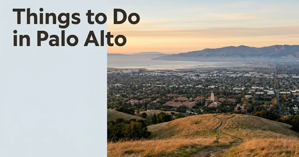
Best Things To Do in Palo Alto, CA: Your 2026 Guide
Palo Alto packs more intellectual and architectural character per square block than almost any city its size in California. The best things to do in Palo Alto span Stanford’s landmark campus, serious trail hiking, and one of the Bay Area’s best local dining corridors.
The city sits at the geographic and cultural heart of Silicon Valley, home to Stanford University and the Hewlett-Packard Garage at 367 Addison Avenue, where two engineers built the company that sparked the modern tech industry. That history is still physically present and genuinely worth seeking out.
This guide covers every major attraction, neighborhood, outdoor experience, and dining option in honest, specific detail. It also tells you what to skip, when to visit, and what most day-trippers miss entirely.
Things to Do in Palo Alto: The Honest Destination Overview
Palo Alto is a compact, walkable city that rewards curious travelers willing to move beyond the Stanford campus and University Avenue’s most-photographed blocks.
The city measures roughly 26 square miles, with its most visitor-relevant experiences concentrated in three zones: the Stanford University campus in the west, the Downtown/University Avenue corridor in the center, and the Baylands natural area along the eastern shoreline of San Francisco Bay.
These zones are not walkable between each other. Baylands sits about 3 miles from the train station. Plan for transit, a rental bike, or a car if you want the full picture.
Visit Palo Alto, the city’s official tourism organization, positions the city as a sophisticated Bay Area day-trip destination. That framing is accurate for the right traveler profile.
Palo Alto is not a budget destination. It is one of the most expensive cities in the United States. Dining, accommodation, and parking all reflect this reality.
The outdoor and cultural attractions, however, are largely free. The Cantor Arts Center, Bay Trail cycling, and Stanford’s public spaces cost nothing to access.
Insider Tip:
- Most visitors arrive by car and spend 45 minutes looking for parking on University Avenue. Arrive by Caltrain instead. The station drops you directly at University Avenue’s eastern end.
- California Avenue, ten blocks south, has better coffee, lower prices, and almost no tourist foot traffic.
- For solo travelers, the Coupa Café on Ramona Street has a communal table culture that makes it genuinely social.
What Makes Palo Alto Worth Visiting
Palo Alto earns a visit through a specific combination of world-class academic architecture, serious natural areas, and dining quality that punches significantly above its city size.
Stanford’s Main Quad alone is architecturally comparable to Oxford’s college courtyards. The sandstone Romanesque buildings, palm-lined paths, and Stanford Memorial Church’s mosaic facades are genuinely remarkable.

The city’s hiking options are also underestimated. Dish Trail’s 3.5-mile loop delivers panoramic South Bay views that most visitors associate with Marin County, not Silicon Valley.
The honest limitation: Palo Alto has almost no nightlife in the traditional sense. By 10 PM on a weekday, most of University Avenue is quiet.
For travelers primarily interested in nightlife or beach access, San Francisco or Santa Cruz are better primary destinations. Palo Alto works best as a complementary stop.
Couples who enjoy architecture, serious food, and a slower pace will find Palo Alto one of the most satisfying day-trip destinations on the entire Peninsula.
Insider Tip:
- The best time to experience Stanford’s campus energy is a Tuesday or Wednesday during the academic year (late August through mid-June), not a summer weekend.
- The Palo Alto Weekly publishes a free events calendar. Check it before your visit for gallery openings, lectures, and farmers market dates.
- Families with children under 10 will find the Palo Alto Junior Museum and Zoo on Middlefield Road more engaging than a campus walk.
Best Things to Do in Palo Alto for Every Traveler Type
The single best activity in Palo Alto depends entirely on who is visiting. Here is a direct breakdown by traveler profile.
| Activity | Best For | Cost Range | Time Required | Insider Note |
|---|---|---|---|---|
| Stanford Main Quad and Memorial Church walk | Couples, culture travelers | Free | 1.5 to 2 hours | Go on a weekday during academic year for full campus atmosphere |
| Cantor Arts Center | Solo travelers, couples, culture travelers | Free | 1.5 to 2.5 hours | Rodin Sculpture Garden outside is always open |
| Dish Trail hike | Solo travelers, active couples, fit seniors | Free | 1.5 to 2.5 hours | Bring water; exposed trail with minimal shade |
| Palo Alto Baylands birdwatching | Families, seniors, nature travelers | Free | 1 to 2 hours | Arrive early morning for best bird activity |
| California Avenue farmers market and dining | Couples, solo travelers, foodies | $10 to $50+ | Half-day | Sunday market; year-round but verify hours before visiting |
| Foothills Nature Preserve hike | Families, outdoor enthusiasts, seniors | Low cost; verify current fees | 2 to 4 hours | Verify current non-resident access policy before visiting |
| HP Garage walking tour (self-guided) | Tech-curious travelers, solo, couples | Free (exterior) | 20 to 30 minutes | Plaque at 367 Addison; residential street; quiet and quick |
| Gamble Garden | Seniors, garden lovers, couples | Low admission; verify current fees | 1 to 1.5 hours | Peak bloom is March through May |
Suggested 1-Day Itinerary for Palo Alto:
- Arrive by Caltrain at Palo Alto station (University Avenue exit). Morning arrival is ideal.
- Walk west on University Avenue to Coupa Café on Ramona Street for coffee and breakfast.
- Walk or ride to Stanford campus. Start at the Stanford Visitor Center on Serra Street for a free map.
- Spend 90 minutes at the Main Quad, Stanford Memorial Church, and Hoover Tower (observation deck typically open for a small fee; verify before visiting).
- Walk to Cantor Arts Center. Allow 90 minutes for the permanent collection and Rodin Sculpture Garden.
- Walk or taxi to California Avenue for lunch. Joanie’s Café or La Bodeguita del Medio are local standbys.
- Afternoon: Choose one outdoor experience: Dish Trail (active) or Baylands (relaxed, birdwatching).
- Return to California Avenue or University Avenue for dinner before your Caltrain departure.
Stanford University Campus Visit
Stanford University is the legitimate centerpiece of any Palo Alto visit, and it earns that status through genuine architectural and cultural weight.
The Main Quad, completed in the 1890s, is one of the most ambitious examples of Richardsonian Romanesque architecture in the United States. Its sandstone arcades, terra-cotta tile roofs, and Palm Drive approach remain architecturally striking.
Stanford Memorial Church anchors the Quad’s eastern end. Its gold Byzantine mosaics on the exterior facade are visible from across the campus.
Campus access is free and open to the public. Parking near campus requires a permit during weekdays. Caltrain followed by a short walk or campus shuttle is the practical choice for most visitors.
The Stanford Visitor Center on Serra Street offers free walking tour maps and runs guided tours on a seasonal schedule. Verify the 2026 tour calendar directly with the Visitor Center before your visit.
Hoover Tower, the campus’s most recognizable landmark at 285 feet, typically offers observation deck access for a small fee. Views extend across the Peninsula on clear days.
For seniors and accessibility travelers: The Main Quad is fully accessible with paved paths throughout. Hoover Tower’s observation deck requires elevator access, which is generally available. Verify current accessibility details with the Visitor Center.
The local alternative: While Hoover Tower is the obvious landmark, experienced campus visitors prefer starting at the Rodin Sculpture Garden adjacent to the Cantor Arts Center. It is always open, free, and crowds are consistently lighter than the Main Quad.
Insider Tip:
- Avoid visiting during Stanford Commencement week in June. The campus becomes inaccessible in practical terms, with road closures and massive crowds.
- The academic year (late August through mid-June) makes the campus feel alive. Summer visits feel quiet by comparison.
- Families: the campus is stroller-friendly. The flat central areas near the Main Quad work well for young children.
Cantor Arts Center and Palo Alto Arts Scene
The Cantor Arts Center at Stanford is one of the strongest free art museums on the West Coast, and almost no casual visitor to Palo Alto visits it.
The permanent collection covers 24 galleries and spans ancient American art, African art, European paintings, and one of the finest collections of Rodin bronzes in the country. The outdoor Rodin Sculpture Garden functions as a public park and is always open, even when the museum is closed.
Admission is free. The museum is closed on Tuesdays and major holidays. Verify the 2026 operating schedule directly with the Cantor before your visit.
The broader Palo Alto arts scene extends beyond Stanford. The Palo Alto Art Center on Newell Road offers rotating contemporary exhibitions with free admission. It serves a different audience from the Cantor, leaning toward community-connected contemporary work.
Palo Alto Players, one of the Bay Area’s longest-running community theater companies, performs at the Lucie Stern Community Center on Middlefield Road. Ticket prices are reasonable by Bay Area standards. Check their 2026 season calendar for showtimes.
For culture travelers: The Cantor alone justifies a Palo Alto trip. Budget at minimum two hours for the permanent collection plus the Rodin Garden.
According to Visit Palo Alto, the city supports more than a dozen arts organizations, a figure that outsizes most comparable American cities of Palo Alto’s population.
The local alternative to Stanford’s art scene: The Palo Alto Art Center draws local artists and hosts exhibition openings that attract actual Palo Alto residents, not campus tourists. If you want to experience art alongside the community rather than alongside other visitors, that is your venue.
University Avenue and Downtown Palo Alto
University Avenue is Palo Alto’s most recognizable street and its most visited corridor, running east from the Caltrain station toward the Stanford campus.
The avenue concentrates Palo Alto’s highest density of restaurants, coffee shops, banks, and boutiques in roughly 12 walkable blocks. It is genuinely pleasant. It is also the most tourist-oriented part of the city.
The blocks between Cowper Street and Waverley Street are the most active for dining and shopping. Restaurants here tend toward the $25 to $50 per person range for dinner.
Tamarine on University Avenue is the most consistently praised restaurant on the street. Vietnamese fine dining, formal service, and a wine list that takes itself seriously. Reservation recommended for dinner.
The local honest assessment: University Avenue is a polished, expensive, and slightly homogenized corridor. It is worth walking. It is not where Palo Alto residents eat every day. That is California Avenue.
The Professorville Historic District, between Waverly and Cowper just south of University Avenue, is a quiet residential neighborhood of late-Victorian and Craftsman homes that few visitors find. It is one of Palo Alto’s most architecturally coherent historic areas.
For couples: A University Avenue dinner followed by a walk through Professorville is a genuinely good Palo Alto evening. The residential streets are quiet, well-lit, and architecturally interesting.
Insider Tip:
- Parking on University Avenue fills quickly on Friday and Saturday evenings. Arrive before 6 PM or use the city parking structures one block off the main street.
- The blocks closest to the Caltrain station are more casual. The best restaurants cluster between Cowper and Waverley Streets.
- Budget travelers: The eastern end of University Avenue near the station has more affordable café options than the blocks closer to campus.
Key Takeaway: Arrive at Palo Alto by Caltrain, walk University Avenue for context, then move to California Avenue for the meal that locals actually recommend.
California Avenue: Palo Alto’s Local Food and Coffee Scene
California Avenue is the best 10-minute argument against spending your entire Palo Alto visit on University Avenue.
Ten blocks south of University Avenue, parallel to the Caltrain line, California Avenue runs through a neighborhood of smaller restaurants, independent coffee roasters, and a Sunday farmers market that has been running continuously since the early 1980s. The energy is local rather than tourist-facing.
Coupa Café has a California Avenue location in addition to its downtown Ramona Street original. The Venezuelan café culture, small plates, and strong coffee have made it a fixture in both locations. The California Avenue branch has more neighborhood regulars.
Baumé, a Michelin-starred tasting menu restaurant near California Avenue, represents the absolute upper end of Palo Alto dining. Reservations are required well in advance. Budget around $200 to $350 per person before wine for the full tasting experience. Verify 2026 pricing and availability directly with the restaurant.
The California Avenue Farmers Market runs on Sundays year-round. It is smaller and more produce-focused than San Francisco’s Ferry Building market, but the local vendor quality is high. Verify current hours with the City of Palo Alto before visiting.
For budget travelers: California Avenue has more affordable options than University Avenue. Several casual lunch spots land in the $12 to $20 per person range.
For solo travelers: The farmers market on a Sunday morning is one of Palo Alto’s genuinely social public spaces. The small format makes it easy to interact with vendors.
The local alternative to Baumé: For a Michelin-adjacent experience at more approachable prices, Evvia Estiatorio on Emerson Street offers Greek wood-fire cooking with a loyal local following and a more relaxed atmosphere than a formal tasting menu.
Dish Trail and Palo Alto Outdoor Activities
The Dish Trail is a 3.5-mile loop maintained by Stanford University through the hills above campus, and it delivers some of the most accessible panoramic views available anywhere on the San Francisco Peninsula.
The trail gets its name from the Stanford Dish, a large radio telescope that sits visibly along the route. The views from the trail’s high points span the entire South Bay, the Santa Cruz Mountains, and on clear days extend to Mount Tamalpais in Marin County.
Trail access is free. The primary trailhead is at 3201 Junipero Serra Boulevard in Palo Alto. The lot fills quickly on weekends before 9 AM. Arrive early or Uber directly to the trailhead.
The trail is unpaved gravel and exposed for most of its length. There is minimal shade. On days above 75°F, water is not optional.
Elevation gain is moderate, approximately 400 feet over the 3.5-mile loop. Most reasonably fit adults complete it in 75 to 100 minutes. The trail is not stroller-friendly. Kids under 8 may find the length and exposure challenging.
For active couples: Dish Trail in the morning, followed by brunch on California Avenue, is the best half-day Palo Alto itinerary. The sequence is tight, local, and genuinely satisfying.
For seniors: The gravel surface and moderate elevation require sturdy footwear. The trail is not accessible for mobility aids. Baylands is a better choice for this profile.
The local alternative to Dish Trail: The Arastradero Preserve, managed by the City of Palo Alto, offers 610 acres of oak woodland trails south of the Dish. Less famous, significantly quieter on weekends, and more varied in terrain and wildlife encounters.
Insider Tip:
- The trail is closed on certain holidays and for maintenance periods. Verify access at the Stanford Dish trail official page before visiting.
- Early morning visits deliver the clearest bay views before afternoon haze develops.
- The trail has limited cell service in the lower portions. Download an offline map before starting.
Palo Alto Baylands Nature Preserve
The Palo Alto Baylands Nature Preserve is the largest remaining expanse of undisturbed tidal marsh in San Francisco Bay, spanning approximately 1,940 acres along Palo Alto’s eastern shoreline.
For most visitors, Baylands is an unexpected discovery. It is a serious birdwatching site, not a manicured nature walk. Over 100 bird species have been recorded here, including great egrets, black-necked stilts, American avocets, and, in winter, large shorebird concentrations.
The Lucy Evans Baylands Nature Interpretive Center offers free exhibits on the salt marsh ecosystem. It is typically open on weekend mornings. Verify 2026 operating hours directly with the City of Palo Alto Parks and Recreation Department before visiting.
The paved trail along the slough is flat, wide, and fully accessible. The preserve is one of Palo Alto’s most genuinely family-friendly outdoor experiences, with a playground near the main parking area.
Parking at Embarcadero Road near the preserve entrance is free. The location is approximately 3 miles from the Caltrain station. Cycling from downtown Palo Alto via the San Francisco Bay Trail is the best car-free approach.
For families: Baylands is one of the few Palo Alto outdoor experiences that works well for children under 10. The flat, paved trail and wildlife viewing are engaging for younger ages.
For seniors and accessibility travelers: Baylands is the most accessible outdoor experience in Palo Alto. Paved paths, flat terrain, and parking close to the preserve entrance make it workable for a wide range of mobility levels.
According to the Midpeninsula Regional Open Space District, the Bay Trail corridor connecting Palo Alto Baylands to neighboring communities is one of the Bay Area’s most significant wildlife movement corridors.
Key Takeaway: Baylands is the most underrated experience in Palo Alto. Most visitors skip it entirely, which means the trails stay quiet even on busy weekends.
Foothills Park and Palo Alto Hiking
Foothills Nature Preserve (formerly Foothills Park) sits in the hills above Palo Alto, offering 1,400 acres of open space with oak woodland trails, a reservoir, and views of the South Bay.
For years, Foothills Park operated under a controversial residency-only access policy that limited non-Palo Alto residents. A 2022 legal settlement significantly changed access. As of recent years, the preserve has been open to non-residents on a permitted or paid basis. Verify the current non-resident access policy directly with the City of Palo Alto Parks and Recreation Department before your visit. This is the single most important practical note for out-of-town visitors.
The preserve’s trail system includes routes ranging from easy, flat paths around the reservoir to more demanding hilly terrain. The Orchard Trail and Canyon Trail system together offer a satisfying 3 to 5-mile loop for moderate hikers.
Foothills is significantly less crowded than the Dish Trail on weekends, primarily because fewer visitors know about it. The oak woodland setting is distinct from the Dish’s exposed grassland terrain.
For families: The reservoir area has flat, accessible paths suitable for children. The longer backcountry trails are not suitable for strollers. Pack snacks and sun protection.
For seniors and accessibility travelers: The reservoir-adjacent paths are manageable. The hillier trail sections require sturdy footwear and moderate fitness. Confirm current facility conditions before visiting.
The local alternative: If Foothills is at capacity or access conditions are uncertain, Arastradero Preserve off Arastradero Road is City of Palo Alto open space with consistent public access and quieter trail conditions than either Dish or Foothills.
Free Things to Do in Palo Alto
Free activities cover a substantial range of Palo Alto’s strongest experiences.
The Cantor Arts Center charges no admission. The Rodin Sculpture Garden is always open at no cost. Stanford’s Main Quad, Memorial Church exterior, and campus grounds are freely accessible.
Free activities list:
- Cantor Arts Center permanent collection and Rodin Sculpture Garden (free; closed Tuesdays; verify 2026 hours)
- Stanford Main Quad and campus walk (always free, self-guided)
- Stanford Memorial Church (exterior always accessible; interior depends on services schedule)
- Palo Alto Art Center exhibitions on Newell Road (free admission)
- Palo Alto Baylands Nature Preserve trail walking (free, parking at Embarcadero Road)
- HP Garage exterior and plaque at 367 Addison Avenue (self-guided; free)
- Dish Trail at Stanford (free; trailhead parking free but fills early)
- San Francisco Bay Trail cycling route through Palo Alto (free)
- Professorville Historic District walking tour (self-guided; free)
- California Avenue Farmers Market (free entry; vendor purchases optional)
For budget travelers: A full day in Palo Alto, anchored on the free attractions above, requires spending money only on food and transportation. The core cultural and outdoor experiences cost nothing.
For solo travelers: The self-guided HP Garage visit combined with a Stanford campus walk is one of the most satisfying free half-days in Silicon Valley. The history is genuinely present in the physical environment, not just in museum displays.
Honest note on what is not free: Hoover Tower observation deck charges a small fee. Gamble Garden charges seasonal admission. Baumé and the top University Avenue restaurants are premium-priced. Accommodation in Palo Alto is expensive without exception.
Day Trips Near Palo Alto
Palo Alto’s location on the Peninsula makes it a functional base for four distinct day-trip directions.
| Destination | Distance from Palo Alto | Drive Time | Transit Option | Best For |
|---|---|---|---|---|
| San Francisco | 35 miles north | 45 to 75 minutes by car | Caltrain to SF, 50 to 65 minutes | First-time Bay Area visitors |
| Santa Cruz | 40 miles southwest | 50 to 70 minutes by car | No direct transit | Beach, boardwalk, redwood access |
| Half Moon Bay | 25 miles northwest via Highway 92 | 35 to 45 minutes by car | No direct transit | Coastal scenery, surfing culture |
| San Jose | 20 miles southeast | 25 to 35 minutes by car | Caltrain, 30 minutes | Tech museums, SAP Center events |
| Filoli Historic House and Garden (Woodside) | 10 miles north | 20 minutes by car | No direct transit | Architecture, formal gardens, seasonal blooms |
Filoli Historic House and Garden in Woodside is the most underused day-trip option from Palo Alto. The 654-acre estate with 16 acres of formal English gardens operated by the National Trust for Historic Preservation is 20 minutes away and draws a fraction of the crowds of Palo Alto’s Stanford campus.
For families: Santa Cruz offers the boardwalk, beach, and enough child-directed attractions to fill a full day. The Mountain Charlie Road route through the Santa Cruz Mountains adds scenic value on the drive.
For couples: Half Moon Bay in the morning for coastal walks, then return to Palo Alto for a California Avenue dinner. This day-trip loop covers two distinct California landscapes in a single day.
Key Takeaway: Filoli in Woodside is 20 minutes from Palo Alto and almost completely unknown to visitors who don’t live on the Peninsula. It is the strongest single day-trip addition to a Palo Alto itinerary.
Palo Alto Restaurants and Dining
Palo Alto’s dining scene is genuinely strong for a city of roughly 66,000 people, driven partly by Stanford’s faculty and research community and partly by Silicon Valley’s concentration of high-income residents.
University Avenue carries the densest restaurant concentration. Tamarine (Vietnamese fine dining), Joya (Spanish-influenced, lively atmosphere), and Evvia Estiatorio (Greek, consistently strong) are the three most locally durable options on and near the main corridor.
California Avenue runs a more casual but still high-quality range. La Bodeguita del Medio brings Cuban cooking and a lively bar atmosphere. Joanie’s Café is a longtime local breakfast institution with consistent quality and reasonable prices by Palo Alto standards.
Budget dining on University Avenue is limited. The most affordable sit-down options land around $15 to $22 per person for lunch. California Avenue has slightly more accessible pricing at the café end of the spectrum.
For couples: A Baumé tasting menu reservation is one of the most distinctive dinner experiences on the Peninsula. Book weeks in advance and verify current availability for 2026.
For families: Restaurants near Stanford’s campus tend toward adult-oriented dining. The California Avenue corridor has slightly more casual options suited to families with older children.
The local alternative to University Avenue’s restaurant row: The Town and Country Village shopping center on El Camino Real has a cluster of long-standing local restaurants and cafés that residents use regularly. It lacks the walkability of University Avenue but trades tourist-facing energy for actual neighborhood character.
Insider Tip:
- Sunday brunch on California Avenue after the farmers market is a genuine local ritual. Arrive before 10 AM to avoid a wait at the most popular spots.
- Reservations are required at Baumé and strongly recommended at Tamarine for Friday and Saturday dinner.
- The coffee at Coupa Café is Venezuelan-style, which means strong, sweet, and distinct from standard Bay Area third-wave coffee culture. Worth trying even if you prefer your coffee black.
Seasonal Guide to Visiting Palo Alto
The best time to visit Palo Alto is September through November or March through May. The worst is June, specifically during Stanford Commencement weekend.
| Season | Weather | Crowds | Accommodation Prices | Best Activity |
|---|---|---|---|---|
| Spring (March to May) | 60s to 70s°F, partly cloudy, occasional rain | Moderate; academic year in session | Moderate to high | Gamble Garden bloom, campus energy at peak |
| Summer (June to August) | 60s to 80s°F, bay fog common | High; June graduation surge | High to very high | Dish Trail morning hikes; Baylands birdwatching |
| Fall (September to November) | 65 to 78°F, clearest skies of the year | Moderate; ideal conditions | Moderate | Dish Trail views, outdoor dining, campus events |
| Winter (December to February) | 50s to 60s°F, significant rain | Low | Lower | Cantor Arts Center, indoor dining focus |
Stanford Commencement (typically the second weekend of June) is the single most disruptive visitor event. Hotels across Palo Alto, Menlo Park, and Mountain View book out months in advance. Road closures affect the campus area. Prices spike significantly.
Stanford football home games in fall (September through November) create localized traffic and parking congestion near the campus and Stanford Stadium. Plan campus visits for non-game-day weekends if possible.
The Dish Trail is best in fall and early spring when temperatures are mild and the bay views are sharpest. Summer haze frequently reduces visibility from the trail’s high points.
For budget travelers: January and February offer the lowest hotel prices in Palo Alto. The rain makes outdoor activities less appealing, but the Cantor Arts Center and California Avenue dining scene are fully operational.
According to Visit California, the Bay Area’s Mediterranean climate delivers its most reliable outdoor conditions from late September through October, when Pacific storms have not yet begun and summer fog has cleared.
Getting To and Around Palo Alto
Getting to Palo Alto without a car is straightforward. Getting around it once there requires planning.
Caltrain is the primary transit connection. From San Francisco’s 4th and King Station, the Baby Bullet express to Palo Alto runs in approximately 50 to 65 minutes. Trains run frequently during commute hours and on weekends. The Palo Alto station drops riders directly at the eastern end of University Avenue. Verify the 2026 Caltrain schedule and fares directly with the Peninsula Corridor Joint Powers Board before traveling.
From SFO, Caltrain connects via a SamTrans bus shuttle or the BART connection to Millbrae, then Caltrain south to Palo Alto. Total travel time typically runs 60 to 90 minutes depending on connections. Verify current connection options before your visit.
From SJC (San Jose airport), Caltrain connects via VTA bus to the Santa Clara Caltrain station, then northward to Palo Alto. A taxi or ride-share from SJC to Palo Alto takes approximately 25 to 35 minutes by car.
Getting around within Palo Alto:
- Downtown attractions and University Avenue: walkable from the train station.
- Stanford campus: approximately 1.5 miles from the station. Bikeable, or take the free Stanford Marguerite shuttle from the train station.
- Baylands: approximately 3 miles from the station. Bike rental or ride-share needed.
- Dish Trail trailhead: approximately 2.5 miles from campus. Ride-share or bike recommended.
- Foothills Nature Preserve: approximately 5 miles from downtown. Car or ride-share required.
Parking reality: University Avenue metered parking fills quickly on weekend afternoons. The public parking structures on Hamilton Avenue and Ramona Street offer more reliable access. Expect to pay for downtown parking during peak hours.
For seniors and accessibility travelers: The flat terrain of downtown Palo Alto makes it highly walkable. Stanford’s central campus is accessible. The shuttle from the train station to campus is particularly useful for those who prefer to minimize walking distance.
Insider Tip:
- The Stanford Marguerite Shuttle is free to ride and connects the Palo Alto Caltrain station to various points across Stanford campus. It runs on a regular schedule during the academic year.
- Lyft and Uber coverage in Palo Alto is reliable and wait times are typically short.
- Cycling is genuinely viable for most visitors. Several bike rental options operate near the downtown station area. The Bay Trail provides flat, car-free cycling access to Baylands.
Safety and Practical Warnings for Palo Alto
Palo Alto is a very safe city with low violent crime rates. The practical risks for visitors are logistical rather than safety-related.
Key safety and practical facts every visitor should know:
- Dish Trail is exposed. On days above 70°F, dehydration risk is real. Bring at minimum 16 to 20 ounces of water per person. The trail has no water sources along its route.
- Foothills access policy must be verified. Non-resident access rules have changed in recent years. Showing up without confirming current policy risks being turned away. Contact the City of Palo Alto Parks and Recreation directly before visiting.
- Caltrain schedule gaps exist. Late-night service is limited on weekends. If you are planning an evening in Palo Alto, check the last train time to San Francisco before your trip. Missing the last Caltrain means a ride-share to San Francisco, which will be expensive.
- Parking enforcement on University Avenue is active. Meter expiration tickets are routinely issued. Set a phone timer when using metered parking.
- Stanford event scheduling affects the entire city. Check Stanford’s academic and athletics calendar before booking accommodation.
- Bay fog affects summer hiking visibility. Dish Trail views are substantially reduced by marine layer on summer afternoons. Morning visits are always better.
The primary emergency contact for outdoor visitors in Palo Alto is the Palo Alto Police Department (non-emergency) and the City of Palo Alto Parks and Recreation Department for trail and park information.
Frequently Asked Questions About Things to Do in Palo Alto
Is Palo Alto worth visiting for a day trip?
Yes, Palo Alto is worth a day trip, especially for travelers combining the Stanford campus, the Cantor Arts Center, and a meal on California Avenue.
A well-planned day covers the city’s strongest cultural, outdoor, and dining experiences without feeling rushed.
Travelers primarily seeking beaches, nightlife, or budget accommodation will get more from San Francisco or Santa Cruz as a primary destination.
How do I get to Palo Alto from San Francisco without a car?
Take Caltrain from San Francisco’s 4th and King Street station to Palo Alto station, which takes approximately 50 to 65 minutes on the Baby Bullet express.
Caltrain deposits you directly at the eastern end of University Avenue.
Verify the 2026 Caltrain schedule and current fares directly with the Peninsula Corridor Joint Powers Board before traveling.
Is Foothills Park open to non-Palo Alto residents?
A 2022 legal settlement changed the preserve’s previously restrictive residency-only access policy, and the preserve has been more broadly accessible since then.
Verify the current non-resident access policy and any applicable fees directly with the City of Palo Alto Parks and Recreation Department before your visit.
Do not assume access without confirming, as policies are subject to revision.
What is the best neighborhood to explore in Palo Alto?
California Avenue is the best neighborhood for visitors who want a genuinely local Palo Alto experience, with better coffee, more approachable prices, and a Sunday farmers market.
University Avenue is the most walkable for first-time visitors and has the highest restaurant density.
The Professorville Historic District just south of University Avenue is the best option for architecture walkers interested in late-Victorian and Craftsman residential design.
What are the best free things to do in Palo Alto?
The Cantor Arts Center, Stanford Main Quad, the Rodin Sculpture Garden, Palo Alto Baylands Nature Preserve trails, and the Dish Trail are all free to access.
The HP Garage at 367 Addison Avenue and the Palo Alto Art Center on Newell Road are also free.
Verify Cantor Arts Center operating hours before visiting, as it is closed on Tuesdays and major holidays.
When is the worst time to visit Palo Alto?
The worst time to visit is Stanford Commencement weekend in early to mid-June, when hotels sell out months in advance and road closures affect the campus area.
Stanford home football games in fall also cause localized parking and traffic disruption near campus.
January and February have the lowest crowds and hotel prices but bring the Peninsula’s rainy season, which limits the appeal of outdoor activities.
Plan Your Palo Alto Visit with Confidence
Palo Alto rewards travelers who go beyond the Stanford campus walkthrough that most visitors treat as the whole itinerary. The California Avenue food corridor, Baylands, and the Dish Trail together constitute a genuinely distinct Bay Area experience.
Book Caltrain in advance for weekend travel, as trains fill. Make dinner reservations for University Avenue or California Avenue restaurants at least a week ahead for weekend visits. If Foothills Nature Preserve is on your list, confirm current non-resident access policy with the City of Palo Alto Parks and Recreation Department before departure.
Travel conditions, restaurant operations, attraction hours, and access policies change. Verify all key logistics directly with venues and Visit Palo Alto before your trip. The traveler who arrives prepared gets the Palo Alto that actually exists in 2026, not the version described in a guide written three years ago.