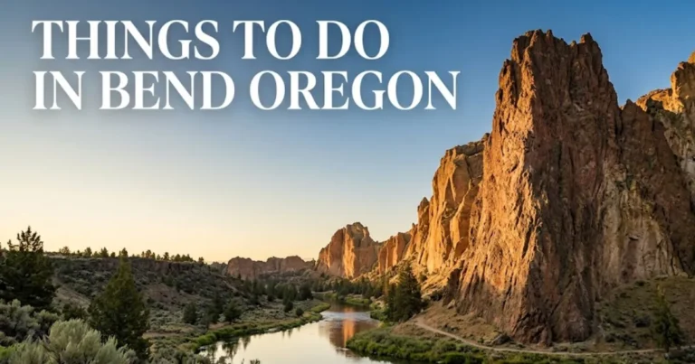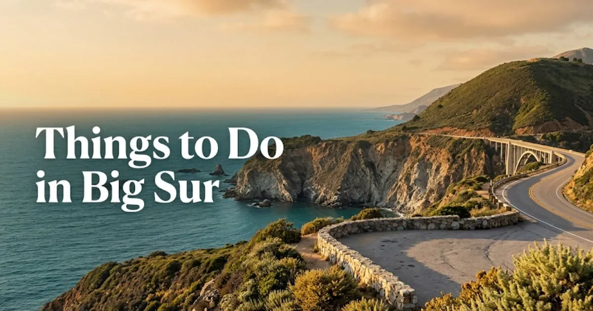
16 Best Things to Do in Big Sur, California in 2026
Big Sur is not a town. It is a 90-mile stretch of Highway 1 with no stoplights, no grocery stores, and no gas stations for 40 miles.
You come here for the most dramatic coastal scenery in the continental United States. You need a full tank of gas, a plan for food, and realistic expectations about what you can actually fit into one day.
This guide covers exactly where to stop, what to skip, and how to build a real itinerary that works for your travel style.
Things to Do in Big Sur
Big Sur’s essential experiences fall into four categories: scenic pullouts, state park hikes, beach access, and dining stops.
Every stop along Highway 1 requires a vehicle. There is no public transit, no ride-share service, and no alternative to driving yourself.
The stretch between Carmel and Ragged Point typically takes 3 to 4 hours to drive straight through. But you will stop constantly.
| Experience Type | Best For | Time Required | Cost Range |
|---|---|---|---|
| Scenic Pullouts | All travelers | 10-30 minutes each | Free |
| State Park Hikes | Active travelers | 1-4 hours | $10 parking fee |
| Beach Access | Couples, photographers | 30 min-2 hours | Free to $12 parking |
| Dining Stops | All travelers | 45-90 minutes | $15-$40 per person |
| Historic Sites | History and culture travelers | 1-2 hours | $15-$25 per adult |
Key Takeaway: Big Sur rewards travelers who plan stops in advance. Highway 1 has no cell service for most of the drive, so download your maps before departing.
Big Sur Things to Do
Different travelers experience Big Sur completely differently. A solo hiker’s perfect day looks nothing like a family’s road trip stops.
Solo travelers should prioritize the longer hikes: Ewoldsen Trail at Julia Pfeiffer Burns and the Tanbark Trail offer solitude that crowded overlooks cannot match.
Couples and romantic travelers will find Pfeiffer Beach at sunset and dinner at Nepenthe Restaurant deliver the Big Sur fantasy most visitors imagine.

Families with children need shorter stops. The Big Sur River day-use area at Pfeiffer Big Sur State Park offers safe wading and picnic tables that work for young kids.
Budget travelers should load a cooler with food purchased in Carmel or Monterey. Dining in Big Sur runs expensive, and there are no budget grocery options anywhere on the route.
Seniors and accessibility travelers must know that most famous Big Sur viewpoints involve stairs or unpaved paths. The Bixby Bridge north pullout offers paved, level viewing from the parking area itself.
Things to Do in Big Sur California
The iconic Big Sur experience centers on three landmarks that define the region’s identity.
McWay Falls drops 80 feet directly onto a sandy cove inside Julia Pfeiffer Burns State Park. This is the most photographed waterfall on the California coast.
The viewpoint is a short, paved path from the parking lot. It is wheelchair-accessible and takes approximately 10 minutes round-trip, which surprises many visitors expecting a hike.
You cannot access the beach or the waterfall itself. The trail leads only to an overlook, and descending to the cove is prohibited and dangerous.
Pfeiffer Beach delivers purple sand, massive rock formations, and some of the most intense wave action on the California coast. The access road is unmarked from Highway 1 and easy to miss.
Sycamore Canyon Road branches west approximately 1 mile south of the Big Sur Ranger Station. The narrow, two-mile road has no sign for Pfeiffer Beach from the highway.
Parking costs approximately $12 and the lot fills by late morning in summer. Arrive before 10 a.m. or after 3 p.m. to secure a spot.
Key Takeaway: The unmarked turn for Pfeiffer Beach is the single most frequently missed stop in Big Sur. Watch for Sycamore Canyon Road on the west side of Highway 1.
Big Sur Scenic Drive Stops
Highway 1 through Big Sur is the scenic drive stop. But certain pullouts deliver more reward than others.
Bixby Creek Bridge sits 11 miles south of Carmel and is the most photographed bridge on the Pacific Coast. The north side pullout offers the classic angle.
Arrive before 9 a.m. or after sunset for photos without crowds. Midday brings tour buses and a line of cars waiting for the viewpoint parking area.
Hurricane Point provides sweeping views of the coastline in both directions. It sits approximately 2 miles south of Bixby Bridge at the highest elevation on this stretch.
The wind here can be genuinely intense. Bring a jacket even in summer, as the exposure at this elevation surprises visitors dressed for coastal warmth.
Point Sur State Historic Park occupies a volcanic rock formation topped by a working lighthouse from 1889. The light station is visible from Highway 1, but tours require advance booking.
Three-hour guided walking tours operate on a limited schedule, typically Wednesday through Sunday. Reservations sell out weeks in advance during summer and whale migration season.
The lighthouse grounds are not accessible without a tour. Visitors expecting to drive up and walk around independently will be turned away.
McWay Falls Big Sur
McWay Falls drops from the cliffs of Julia Pfeiffer Burns State Park directly onto the sand of a sheltered cove below.
The waterfall flows year-round, fed by McWay Creek. Spring delivers the strongest flow after winter rains recharge the watershed.
The overlook trail is a quarter-mile paved path from the parking area. It takes about five minutes each way and requires no hiking ability.
The trail ends at a fenced overlook approximately 200 feet above the cove. There is no legal or safe route to the beach or the base of the falls.
Descending to the cove has resulted in injuries and rescues. The cliff face is unstable, and the trail beyond the overlook is closed by California State Parks permanently.
Photographers should arrive in late afternoon when the setting sun illuminates the falls directly. Morning light leaves the cove in shadow.
Insider Tip:
- The best photo angle is from the far left side of the overlook deck
- The parking lot fills by 11 a.m. in summer months, so arrive early
- Couples will find the overlook crowded during peak hours but nearly empty at sunset
Pfeiffer Beach Big Sur
Pfeiffer Beach is Big Sur’s most unusual shoreline. Purple sand, created by manganese garnet deposits washing down from the hillsides, streaks the beach after winter storms.
Keyhole Rock dominates the northern end of the beach. This massive sandstone formation has a natural arch that frames sunset light during a few weeks each winter.
The beach sits at the end of Sycamore Canyon Road, an unmarked, two-mile, single-lane descent from Highway 1. There is no sign for Pfeiffer Beach on the highway.
The parking lot holds approximately 60 vehicles. Once full, rangers close the access gate and turn cars away. Weekend summer arrivals after 10:30 a.m. risk closure.
Restrooms and picnic tables are available. There are no food vendors, no lifeguards, and no cell service anywhere on the beach or access road.
Rogue waves pose a genuine hazard here. The beach drops steeply into deep water, and waves arrive without warning even on calm days. Never turn your back on the ocean at Pfeiffer Beach.
Families with young children should exercise extreme caution. The surf is too dangerous for wading, and the rip currents are strong and unpredictable.
According to California State Parks, Pfeiffer Beach experiences the highest number of water rescues in the Big Sur region due to visitors underestimating wave conditions.
Key Takeaway: Pfeiffer Beach is a photography and sunset destination, not a swimming beach. Treat the water as actively dangerous regardless of conditions.
Bixby Bridge Viewpoint
Bixby Creek Bridge spans 714 feet across a deep coastal canyon at a height of 280 feet above the canyon floor.
Completed in 1932, it was the longest concrete arch span in California at the time. The bridge remains one of the most recognized structures on the entire Pacific Coast.
Two viewpoints serve visitors. The north pullout directly off Highway 1 provides the classic postcard angle and requires no walking from your car.
The south viewpoint requires a short walk from a smaller turnout. It offers a less photographed angle but far fewer people.
The north pullout holds approximately 30 vehicles and fills by mid-morning year-round. Sunrise offers the only reliable solitude and the best light on the bridge’s eastern face.
Tour buses stop here constantly between 10 a.m. and 4 p.m. The experience during these hours is more parking lot scramble than scenic moment.
Accessibility note: The north viewpoint is paved and level, making it the single most accessible scenic stop in all of Big Sur for wheelchair users and travelers with mobility limitations.
Drones are prohibited. The area falls within California State Parks jurisdiction, and drone use is banned in all state parks without a permit.
The real local alternative is the view from Old Coast Road, a dirt road that branches east just north of the bridge. The first half-mile offers elevated bridge views without the crowds.
Best Hikes in Big Sur
Big Sur’s hiking trails range from short redwood walks to all-day backcountry treks through the Ventana Wilderness.
Ewoldsen Trail at Julia Pfeiffer Burns State Park climbs 1,600 feet over 4.5 miles round-trip through redwood groves and coastal chaparral. Ocean views open up at the upper switchbacks.
The trail requires solid fitness. The climb is steady and exposed in sections, with poison oak lining much of the route. Long pants are strongly recommended.
Tanbark Trail starts near Partington Cove and climbs steeply through a redwood canyon for 6 miles round-trip. The old tanbark harvesting route feels far more remote than Ewoldsen.
Solo hikers favor this trail for solitude. The lower trailhead is easy to miss, which keeps crowds minimal even in summer.
Buzzard’s Roost Trail at Pfeiffer Big Sur State Park climbs 800 feet over 2.6 miles round-trip to a panoramic ridge viewpoint. Families with older children can manage this route.
The trailhead starts from the Big Sur Lodge parking area. Day-use parking costs $10 and includes access to the Big Sur River swimming holes afterward.
| Trail | Distance | Elevation Gain | Best For | Difficulty |
|---|---|---|---|---|
| Ewoldsen Trail | 4.5 mi RT | 1,600 ft | Fit hikers, solo travelers | Strenuous |
| Tanbark Trail | 6 mi RT | 1,800 ft | Experienced hikers seeking solitude | Strenuous |
| Buzzard’s Roost | 2.6 mi RT | 800 ft | Families with older kids, moderate hikers | Moderate |
| McWay Falls Overlook | 0.5 mi RT | Minimal | All visitors, wheelchair accessible | Easy |
Poison oak is abundant on every Big Sur trail. Learn to identify it before hiking. The plant grows as ground cover, bush, and climbing vine along virtually every trail in the region.
Julia Pfeiffer Burns State Park
Julia Pfeiffer Burns State Park protects the McWay Canyon watershed and the iconic McWay Falls overlook. The park sits approximately 37 miles south of Carmel.
The park entrance is directly off Highway 1 with a clearly marked turn lane. Day-use parking costs approximately $10 per vehicle as of recent years.
Two parking lots serve visitors. The main lot near the entrance fills first. The overflow lot sits approximately 0.3 miles south along Highway 1 with a pedestrian tunnel back to the park entrance.
The Ewoldsen Trail and McWay Falls Overlook Trail both start from within the park. An additional short trail leads to the ruins of the Waterfall House, the former estate of the family who once owned this stretch of coastline.
Camping exists at two environmental campsites within the park. Both require advance reservations through the California State Parks reservation system, and both book out months ahead for summer dates.
The park has no restaurant, no store, and no lodging beyond the two campsites. Bring all food, water, and supplies with you.
According to California State Parks, Julia Pfeiffer Burns sees over 500,000 visitors annually, with the McWay Falls overlook being the single most visited attraction in the Big Sur region.
Big Sur State Parks
Five state parks anchor the Big Sur experience. Each serves a different type of visitor.
Pfeiffer Big Sur State Park offers the most developed facilities in the region. The park includes a lodge, restaurant, camp store, swimming holes on the Big Sur River, and the largest campground in Big Sur.
Families with children find this park the most accommodating. The river wading areas provide safe water play, and the camp store stocks basics otherwise unavailable for 40 miles.
Andrew Molera State Park protects the largest undeveloped coastal prairie in California. The park offers beach access via a 1-mile level trail from the parking area.
The trail crosses the Big Sur River without a bridge. Seasonal water levels determine whether crossing is possible without getting wet. Seniors and families with young children should check conditions before committing.
Garrapata State Park sits at the northern edge of Big Sur approximately 7 miles south of Carmel. The park offers two miles of beach access and the Soberanes Canyon Trail through coastal redwoods.
Parking is free along the highway pullouts. The park has no entrance station, no restrooms at most trailheads, and no developed facilities beyond the trails themselves.
Point Lobos State Natural Reserve technically sits north of Big Sur proper but serves as the natural starting point for a southbound Highway 1 drive. The reserve’s Cypress Grove Trail is among the most scenic short walks on the entire California coast.
Point Sur State Historic Park occupies a volcanic rock topped by the 1889 Point Sur Lightstation. Lighthouse tours require advance reservations and involve a strenuous uphill walk.
Big Sur Beaches
Big Sur beaches share one common trait: dramatic beauty paired with dangerous water.
Pfeiffer Beach leads the list for photography and purple sand. But the surf is deadly and swimming is not recommended under any conditions.
Andrew Molera Beach offers the longest stretch of walkable sand in Big Sur. The one-mile trail from the parking lot keeps crowds manageable compared to drive-up beaches.
The beach here is popular with surfers, but rip currents are strong. Swimming is only advisable near the river mouth where freshwater reduces wave force.
Sand Dollar Beach sits at the southern end of Big Sur near the Monterey-San Luis Obispo county line. At nearly a mile long, it is the largest sandy beach in the Big Sur region.
The beach is accessible via a staircase from the parking lot above. Parking costs approximately $10 through the Los Padres National Forest day-use fee system.
Sand Dollar Beach faces south, which means it receives more direct sunlight than north-facing Big Sur coves. It is the best beach in the region for actually spending time on the sand rather than photographing it from an overlook.
Garrapata Beach requires a short walk from the highway pullout. The two-mile beach sees fewer visitors than Pfeiffer or Sand Dollar, especially on weekday mornings.
All Big Sur beaches share the same warning: no lifeguards, unpredictable sneaker waves, cold water year-round, and strong rip currents. Treat every beach as a viewing and walking experience, not a swimming destination.
Highway 1 Big Sur Stops
The following stops appear in north-to-south driving order for travelers starting from Carmel and heading toward San Simeon.
Point Lobos State Natural Reserve (just north of Big Sur proper) deserves a stop for the Cypress Grove Trail and China Cove. Parking costs $10 and fills by 9 a.m. on weekends.
Garrapata State Park appears next, approximately 7 miles south of Carmel. The Calla Lily Valley blooms here in late winter, typically February through March.
Bixby Creek Bridge sits at mile marker 12 south of Carmel. The north pullout provides the classic photo and requires no hiking.
Point Sur State Historic Park appears at mile marker 19. The lighthouse tour requires advance booking. The view from the highway pullout is free and worthwhile even without a tour.
Pfeiffer Big Sur State Park entrance sits at mile marker 37. This is the best stop for restrooms, the camp store, a sit-down meal at the lodge, and the Big Sur River wading area.
Nepenthe Restaurant sits at mile marker 41. The terrace offers ocean views and the best dining view in Big Sur.
Julia Pfeiffer Burns State Park appears at mile marker 45. McWay Falls is the essential stop. The parking lot fills early.
Partington Cove trailhead sits just south at mile marker 46. The short hike to the cove takes about 20 minutes round-trip and features a historic tunnel.
Sand Dollar Beach appears near mile marker 64 at the southern end of Big Sur. This is the last major stop before the landscape transitions toward San Simeon.
Big Sur Road Trip Stops
A successful Big Sur road trip requires planning stops around three hard constraints: limited daylight, no cell service, and zero services for 40 central miles.
Start your drive with a full tank of gas purchased in Carmel, Monterey, or Morro Bay. The gas station at the Big Sur River Inn occasionally operates but is unreliable and charges premium prices.
Pack food and water sufficient for the entire day. Big Sur dining exists but is expensive and concentrated at just a few locations. There are no convenience stores or grocery options.
Download offline maps for the entire route before departing. Google Maps offline mode covers the Highway 1 corridor adequately. Cell service vanishes completely for most of the drive.
Plan your farthest-south stop before starting the drive. Turn around at a specific landmark like Sand Dollar Beach or Ragged Point rather than driving until you feel finished.
The ideal pacing is one major stop per hour of driving. A typical full day accommodates 5 to 7 meaningful stops with time to enjoy each one.
According to the Big Sur Chamber of Commerce, most visitors underestimate the time required for the full Highway 1 drive. The 90-mile stretch typically takes 5 to 7 hours with stops, not the 3 hours GPS predicts for nonstop driving.
Key Takeaway: The single biggest mistake visitors make is driving too far south and then facing a 3-hour return drive with no energy, no food, and no daylight.
Things to Do Near Big Sur
Several worthwhile destinations sit within an hour’s drive of Big Sur proper, useful for extending your trip or finding services the Big Sur corridor lacks.
Point Lobos State Natural Reserve lies just south of Carmel. The reserve offers the finest short coastal walks north of Big Sur itself. The Cypress Grove Trail loops through one of only two naturally occurring Monterey cypress groves in the world.
Parking costs $10 and the lot fills before 9 a.m. on weekends year-round. Arrive early or park on Highway 1 and walk in.
Carmel-by-the-Sea provides the dining, shopping, and lodging infrastructure that Big Sur completely lacks. The town’s beach, tasting rooms, and walkable downtown make it the natural base for a Big Sur road trip.
Hotel rates in Carmel run high, but the town offers everything from inns to full-service resorts. Budget travelers should look at Monterey for more affordable lodging 15 minutes north.
Hearst Castle in San Simeon sits approximately 65 miles south of Big Sur proper. The William Randolph Hearst estate tours require advance reservations and offer a completely different experience from Big Sur’s natural attractions.
Ragged Point marks the southern boundary of the Big Sur coast. The Ragged Point Inn offers the last reliable restrooms, food, and fuel before the long stretch of Highway 1 that climbs into the Santa Lucia Range southbound.
Andrew Molera State Park sits within Big Sur proper but is often overlooked. The park offers beach access, coastal prairie hiking, and a seasonally operating walk-in trail camp.
Big Sur Restaurants and Dining
Big Sur dining is limited, expensive, and occasionally excellent. There are approximately six reliable food options in the entire 90-mile corridor.
Nepenthe Restaurant at mile marker 41 is the essential Big Sur dining experience. The terrace overlooks the coast 800 feet above the ocean, and the Ambrosia burger has been the signature dish since the 1950s.
Entrees run $20 to $45 as of recent years. The view is what you are paying for, and it genuinely delivers. Reservations are not accepted, and weekend wait times can exceed 90 minutes at peak hours.
Big Sur Bakery sits just north of Nepenthe at the Loma Vista complex. Breakfast pastries and wood-fired pizzas anchor the menu. Prices run slightly lower than Nepenthe, and the outdoor seating is less dramatic but more relaxed.
Big Sur River Inn restaurant offers riverside seating with Adirondack chairs placed directly in the shallow Big Sur River. The food is standard roadhouse fare, but eating with your feet in the river on a hot day is a genuine Big Sur experience.
COAST Big Sur occupies a gallery space with a cafe. The food is limited to light fare and coffee, but the setting and art are worth a stop.
Deetjen’s Big Sur Inn serves breakfast and dinner in a historic 1930s inn dining room. The atmosphere is the draw, with low ceilings, fireplaces, and a setting that feels genuinely unchanged for decades.
Budget travelers should pack their own food. The nearest grocery stores are in Carmel to the north and Morro Bay to the south. There is no grocery option anywhere in the Big Sur corridor.
Solo travelers will find Nepenthe’s bar seating the easiest way to get seated quickly. The Cafe Kevah below Nepenthe offers lighter fare and faster service for those who do not want a full restaurant experience.
Key Takeaway: Never arrive at a Big Sur restaurant without a backup plan. Limited hours, seasonal closures, and wait times can leave you hungry 40 miles from the nearest alternative.
Big Sur Itinerary 1 Day
One day in Big Sur covers the highlights from Bixby Bridge to McWay Falls with time for one meaningful hike and a proper meal.
Morning:
- Depart Carmel or Monterey by 7:30 a.m. with a full tank of gas and packed snacks
- Stop at Bixby Creek Bridge north pullout for sunrise photos without crowds
- Continue south to Pfeiffer Big Sur State Park for the Buzzard’s Roost Trail or a shorter walk along the Big Sur River
Late Morning:
- Drive to Pfeiffer Beach via Sycamore Canyon Road before the parking lot fills
- Spend 45 minutes photographing Keyhole Rock and the purple sand
- Exit Pfeiffer Beach by 11:30 a.m. to avoid the midday access gate closure
Lunch:
- Arrive at Nepenthe Restaurant by 11:45 a.m. to secure a terrace table before the lunch rush
- Allow 60 to 90 minutes for a relaxed meal with the full coastal view
Afternoon:
- Drive 10 minutes south to Julia Pfeiffer Burns State Park for the McWay Falls overlook
- If time and energy allow, hike the Ewoldsen Trail for 2 to 3 hours of redwood and ocean views
- If skipping the long hike, add a stop at Partington Cove for the quick coastal access trail
Late Afternoon:
- Begin the drive back north by 4 p.m. to avoid the sunset return on unfamiliar winding roads
- Optionally stop at Garrapata State Park for a final beach walk before returning to Carmel
This itinerary is aggressive for families with young children. For families, skip Pfeiffer Beach and Ewoldsen Trail, substitute the Big Sur River wading area, and end the day at Sand Dollar Beach where the sand is safer for kids.
Budget travelers should substitute a packed lunch for Nepenthe, saving $30 to $50 per person, and focus on the free highway pullouts and beaches.
Safety and Practical Warnings for Big Sur
Big Sur’s beauty conceals hazards that surprise visitors who arrive expecting a developed tourist environment.
The coastline has no emergency services along most of Highway 1. Ambulance response times can exceed 45 minutes in remote sections.
Cliff safety is your personal responsibility. Most pullouts and viewpoints have no guardrails despite drop-offs of hundreds of feet. Keep children within arm’s reach at all times near any cliff edge.
Rogue waves kill. Pfeiffer Beach and all Big Sur beaches experience unpredictable wave surges that can sweep people from rocks and sand into cold, rough water. Never turn your back on the ocean.
Poison oak grows along every trail in Big Sur. Wear long pants on any hike. Wash exposed skin with cool water and soap within two hours of contact to reduce reaction risk.
Highway 1 closes without warning. Landslides, rockslides, and winter storm damage frequently shut down sections for months at a time. Check Caltrans highway conditions before departing and have a backup route plan.
Cell service is absent on most trails, beaches, and long stretches of Highway 1. Download maps and directions before entering the corridor. Tell someone your planned stops and expected return time.
Fuel and food are unavailable for the 40-mile central stretch between Carmel Highlands and Ragged Point. Start with a full tank. Carry water and food sufficient for the entire day.
According to the Big Sur Chamber of Commerce, the most common emergency calls involve visitors stranded without fuel, hikers lost without maps, and beachgoers caught by rogue waves.
Frequently Asked Questions About Big Sur
What is the best time of year to visit Big Sur?
The best months are September and October for the clearest skies and warmest temperatures.
April and May offer green hillsides, wildflowers, and gray whale migration viewing from shore overlooks.
Avoid June through August for heavy coastal fog and maximum crowds, and December through February for road closure risk.
How long does it take to drive through Big Sur?
The 90-mile Highway 1 stretch takes 5 to 7 hours with stops.
Nonstop driving takes approximately 3 hours, but nobody drives Big Sur without stopping.
Plan one major stop per hour of total trip time to avoid rushing the experience.
Do you need reservations for Big Sur state parks?
Day-use parking does not require reservations, but lots fill by mid-morning in peak season.
Camping and lighthouse tours require advance reservations, often months ahead for summer dates.
Check California State Parks reservation system for current availability and booking windows.
Is Big Sur suitable for families with children?
Families can enjoy Big Sur with the right expectations and stop selection.
Pfeiffer Big Sur State Park offers the most family-friendly facilities including river wading and a camp store.
Cliff edges and dangerous surf make constant supervision mandatory for young children at all other Big Sur stops.
Where can you eat in Big Sur?
Nepenthe Restaurant, Big Sur Bakery, Big Sur River Inn, and Deetjen’s offer the primary dining options.
All run expensive by any standard and have limited hours with no reservations at most locations.
Pack food from Carmel or Monterey as a backup for any Big Sur day trip.
Is Big Sur worth visiting right now with Highway 1 closures?
Highway 1 has experienced extended closures in recent years from landslides and storm damage.
Check Caltrans District 5 road conditions for current Highway 1 status before planning any Big Sur trip.
When the highway is open, the full Big Sur experience is accessible with no significant access restrictions.
The Essential Big Sur Truth
Big Sur delivers exactly what it promises: the most dramatic coastal scenery in the continental United States. It also demands more planning than most visitors expect.
No gas, no groceries, no cell service, and no walkable town means you must arrive prepared or you will spend your day stressed instead of awed.
Book your lodging months ahead, start with a full tank, pack food and water, download maps, and accept that you will not see everything in one trip.
Verify Highway 1 conditions with Caltrans, state park hours with California State Parks, and restaurant hours directly with the venues before departing. Conditions change frequently in this remote stretch of coastline, and the traveler who checks ahead has a dramatically better experience than the one who assumes everything will be open and accessible.