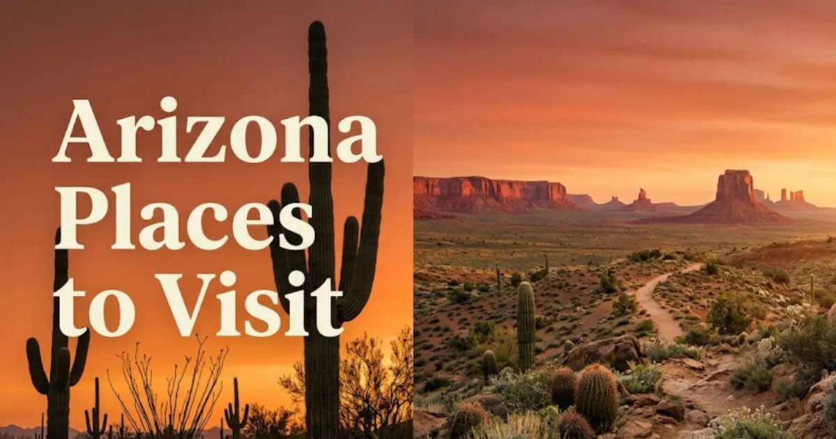
15 Best Arizona Places to Visit in 2026 | Complete Guide
Arizona places to visit in 2026 span one of the widest geographic ranges of any US state. From the Colorado Plateau’s billion-year-old canyon walls to Tucson’s Sonoran Desert saguaro forests, the variety is genuine.
Visit Arizona, the state’s official tourism organization, reports Arizona hosts over 40 million visitors annually. The Grand Canyon alone draws over six million people per year to its South Rim.
This guide covers 15 specific destinations across Arizona, with honest crowd assessments, traveler profile distinctions, and exact booking logistics. You’ll leave knowing which destination matches your travel style and when to go.
Arizona Places to Visit: What Makes This State Worth Your Time
Arizona rewards travelers who plan beyond the obvious itinerary. The state’s defining characteristic is geographic extremes: desert lowlands below 1,000 feet and alpine forest above 9,000 feet exist within a four-hour drive of each other.
The Arizona Office of Tourism identifies six distinct travel regions. These are the Colorado Plateau country in the north, the Sonoran Desert in the south, the Verde Valley in the central region, the White Mountains in the east, the Prescott Highlands, and metro Phoenix and Scottsdale.
That range matters practically. Flagstaff sits at 6,910 feet elevation. Phoenix sits at 1,086 feet. On a July afternoon, Flagstaff may be 75°F while Phoenix reaches 115°F.
Arizona also has more Native American land than any other US state. Seventeen federally recognized tribes manage significant cultural heritage sites here. Monument Valley and Antelope Canyon sit within Navajo Nation boundaries.
For solo travelers, Arizona’s road-trip infrastructure is genuinely solo-friendly. Well-marked scenic byways, abundant BLM free camping, and cell service along major corridors make independent travel manageable.
Insider Tip:
- The America the Beautiful Annual Pass (approximately $80, verify current price) covers entry to all Arizona national parks and BLM recreation sites. For any trip covering three or more parks, the math is simple.
- Download offline maps via Gaia GPS or Google Maps before entering canyon country. Cell service disappears entirely in many backcountry zones.
- Seniors and travelers with mobility needs: Grand Canyon South Rim’s Rim Trail is paved for approximately 13 miles and wheelchair accessible. Most other Arizona canyon experiences involve significant unpaved terrain.
The 10 Best Places to Visit in Arizona at a Glance
The 10 best places to visit in Arizona, ranked by combination of experience quality and traveler accessibility, are the Grand Canyon, Sedona, Antelope Canyon, Monument Valley, Tucson, Scottsdale, Flagstaff, Havasu Falls, Bisbee, and the Chiricahua National Monument.

| Destination | Best For | Cost Tier | Best Season | Crowd Level |
|---|---|---|---|---|
| Grand Canyon South Rim | All profiles | Mid-range | Sep–Nov, Mar–May | Very High |
| Sedona | Couples, hikers | Premium | Mar–May, Sep–Oct | High |
| Antelope Canyon | Photography | Mid-range+ | Mar–Oct | Very High |
| Monument Valley | Culture, photography | Mid-range | Mar–May, Sep–Nov | Moderate |
| Tucson | Families, seniors | Budget–Mid | Oct–Apr | Low–Moderate |
| Scottsdale | Couples, luxury | Premium | Oct–May | Moderate–High |
| Flagstaff | Families, hikers | Budget–Mid | Jun–Oct | Moderate |
| Havasu Falls | Adventure, hikers | Mid-range+ | Apr–Jun, Sep–Oct | Low (permit required) |
| Bisbee | Solo, couples | Budget | Oct–May | Low |
| Chiricahua NM | Hikers, seniors | Budget | Mar–Nov | Very Low |
This table reflects general 2026 conditions. Verify all pricing and seasonal access directly with each venue or official park before visiting.
Best Places in Arizona to Visit for Outdoor Adventures
Arizona’s best outdoor destinations for active travelers are Saguaro National Park, Chiricahua National Monument, Petrified Forest National Park, and the trail networks surrounding Sedona and Flagstaff.
Saguaro National Park operates two separate districts. The Rincon Mountain District east of Tucson offers backcountry camping and longer trail systems. The Tucson Mountain District west of the city delivers the classic saguaro forest scenery within a shorter hiking range.
Entry fees run approximately $25 per vehicle as of recent years. Verify current NPS fees before visiting.
For families with children over age 8, Saguaro’s shorter loop trails work well. The Valley View Overlook Trail in the west district is under two miles and manageable for most ages.
The Mogollon Rim country east of Flagstaff offers pine forest hiking largely unknown to out-of-state visitors. The West Fork Trail in Oak Creek Canyon near Sedona requires a red rock pass for parking but delivers one of Arizona’s most distinctive trail experiences.
Petrified Forest National Park along Interstate 40 is chronically undervisited despite its Blue Mesa badlands formations. Entry fees run approximately $25 per vehicle. The 28-mile scenic drive requires no hiking at all, making it genuinely accessible for seniors and travelers with mobility needs.
Insider Tip:
- Chiricahua National Monument in southeastern Arizona receives fewer than 100,000 visitors annually. Its Bonita Canyon scenic drive and Massai Point trail offer volcanic rock spire scenery comparable to Utah’s canyon country.
- Arizona Trail through-hikers use the 800-mile route from Mexico to Utah. Day-hike sections near Flagstaff and the Santa Catalina Mountains north of Tucson are accessible for non-through-hikers.
Key Takeaway: The America the Beautiful Annual Pass pays for itself at three Arizona national parks. Buy it before your first park entry.
Grand Canyon, Arizona
The Grand Canyon is 277 river miles long, up to 18 miles wide, and over a mile deep. No description substitutes for standing at the rim and experiencing the scale firsthand.
The South Rim is open year-round. The North Rim closes mid-October through mid-May due to snow. Most first-time visitors use the South Rim, which hosts the majority of services, trails, and viewpoints.
Entry fees run approximately $35 per vehicle as of recent years. The America the Beautiful Pass covers entry. Verify current fees with the National Park Service.
Bright Angel Trail is the most accessible descent trail from the South Rim. Rangers strongly advise against descending to the Colorado River and back in a single day. The round-trip distance is approximately 18 miles with 4,340 feet of elevation change.
For families with young children, rim-level viewing along the Rim Trail delivers the full visual experience without trail hiking. The free shuttle system runs multiple routes across the South Rim from spring through fall.
Couples seeking a more intimate South Rim experience should walk east along the rim to Mather Point at dawn. The eastern viewpoints at Desert View are 25 miles from Grand Canyon Village and draw a fraction of the central rim crowd.
Seniors and accessibility travelers: The Rim Trail’s paved section is wheelchair accessible. The Grand Canyon Visitor Center is ADA compliant. Shuttle buses have wheelchair ramps. Most named viewpoints are accessible from parking areas.
What most visitors get wrong about the Grand Canyon: They underestimate the heat inside the canyon. Temperatures at the canyon floor run 20 to 30 degrees hotter than the rim. Summer canyon floor temperatures regularly exceed 110°F. Rangers respond to hundreds of heat exhaustion rescues annually.
To visit the Grand Canyon responsibly:
- Book lodging inside the park (Bright Angel Lodge, El Tovar) six months to one year in advance. Lodging fills quickly.
- If day-hiking, start before 7 a.m. and be off exposed trails by 10 a.m. in summer.
- Carry at least one liter of water per hour of hiking.
- The free shuttle eliminates parking stress on the South Rim. Use it.
- East Rim viewpoints at Yaki Point and Grandview Point offer comparable scenery with significantly fewer visitors than Mather Point.
Sedona, Arizona
Sedona offers the most distinctive desert landscape in Arizona for travelers who want natural beauty without backcountry logistics. The red sandstone buttes surrounding the town are geologically distinct from the Grand Canyon but equally dramatic at close range.
Cathedral Rock and Bell Rock are the two most-photographed formations. Cathedral Rock’s trail is short (approximately 1.2 miles round trip) but steep, with exposed scrambling near the summit that is not suitable for young children or travelers with limited upper-body mobility.
Parking throughout Sedona requires a Red Rock Pass (approximately $5 to $15 per day depending on zone, verify current rates). The pass system reduces but does not eliminate parking congestion at the most popular trailheads.
Sedona is primarily a couples and romance travel destination. The concentration of spa resorts, wine tasting venues at Page Springs Cellars and Arizona Stronghold Winery nearby in the Verde Valley, and intimate canyon views make it Arizona’s strongest romantic travel destination.
For solo travelers, Sedona’s town center along AZ-89A through Uptown Sedona can feel heavily commercialized. The town does enormous tourism volume. Tlaquepaque Arts and Shopping Village on AZ-179 is genuinely worth the hour, with independent galleries in a Spanish colonial courtyard setting.
The honest assessment of Sedona: The town itself is heavily tourist-oriented. The landscape that surrounds it is extraordinary. Plan your visit around early morning trail access and you get the latter without fighting the former.
Local alternative to the crowded Sedona core: Drive AZ-89A north from Sedona into Oak Creek Canyon. The canyon road to Flagstaff is one of Arizona’s best scenic drives. Slide Rock State Park at the canyon’s heart operates on timed-entry during summer, so check availability in advance.
| Sedona Experience | Best For | Season | Advance Booking? |
|---|---|---|---|
| Cathedral Rock Trail | Couples, photographers | Mar–May, Oct | No, arrive before 8 a.m. |
| Bell Rock Trail | Families, beginners | Mar–Jun, Sep–Nov | No |
| Boynton Canyon Trail | Solo, spiritual interest | Mar–Nov | No |
| Oak Creek Canyon Drive | All profiles | Year-round | No |
| Page Springs Cellars | Couples | Sep–May | Recommended weekends |
Antelope Canyon and Horseshoe Bend, Arizona
Antelope Canyon is the most-visited slot canyon in the United States, located on Navajo Nation land near Page, Arizona. Access is exclusively through authorized Navajo Nation tour operators. Independent entry is not permitted.
Two separate canyons operate nearby: Upper Antelope Canyon (known locally as “The Crack”) and Lower Antelope Canyon (“The Corkscrew”). Upper Antelope is wider, more photographed, and more expensive. Lower Antelope involves more ladder climbing and offers a slightly more raw canyon experience.
Tours run approximately $60 to $100 per adult depending on operator and tour type, as of recent years. Photography tours at Upper Antelope Canyon cost more. Book four to six months in advance for spring and fall visits. Verify pricing with current operators.
Horseshoe Bend sits three miles from Page and requires a short 1.5-mile round-trip hike with minimal elevation gain. There is no shade on the trail or at the overlook. Parking requires a fee (verify current rate with the Horseshoe Bend recreation area).
The honest crowd assessment: Antelope Canyon tours are extraordinary but scripted. You move through in a group of 20 or more. The light beam photography window at Upper Antelope Canyon operates only around midday from March through October. Budget tours rush through in 25 minutes.
The local alternative for slot canyon seekers: Antelope Canyon X, operated by Adventurous Antelope Canyon Tours, is a third slot canyon in the Page area. It operates in smaller group sizes and costs less than Upper Antelope. White Pocket in the Vermilion Cliffs National Monument offers similar swirling sandstone formations with essentially zero crowds, though access requires a high-clearance four-wheel-drive vehicle.
For budget travelers, Horseshoe Bend delivers one of Arizona’s most iconic views for the cost of parking plus a short walk. Antelope Canyon’s tour cost is non-negotiable.
Key Takeaway: Antelope Canyon requires advance booking of four to six months for spring visits. Book the tour first, then arrange travel around it.
Monument Valley, Arizona
Monument Valley Navajo Tribal Park sits on the Utah-Arizona border within Navajo Nation territory. The Mittens, Merrick Butte, and the sweeping red mesa formations are the most recognizable desert landscape in American film history.
Access to the valley floor requires either a guided Navajo tour or a self-drive permit on the 17-mile Valley Drive dirt road. Valley Drive is passable in standard passenger vehicles in dry conditions. After rain, it requires a high-clearance vehicle.
Entry fees run approximately $8 to $10 per person as of recent years. Guided jeep tours from local Navajo operators cost significantly more and last two to four hours. Verify current fees with the Monument Valley Navajo Tribal Park visitor center.
Sunrise and sunset photography at Monument Valley are extraordinary. The eastern Mittens formation catches first light within minutes of dawn. For photography travelers, staying at The View Hotel directly inside the park is the only way to access pre-dawn viewpoints without driving in darkness on unfamiliar dirt roads.
For cultural travelers: Monument Valley is active Navajo Nation territory, not a historical preservation site. Navajo families live, work, and conduct ceremonies here. Respectful visitor behavior and engagement with Navajo-guided tour operators directly supports the tribal community.
Solo travelers find Monument Valley deeply atmospheric and genuinely moving at low-crowd hours. The midday period from 10 a.m. to 3 p.m. draws the heaviest tour bus traffic. Arrive before 8 a.m. or after 4 p.m. for the best experience.
Insider Tip:
- The free overview viewpoint from the visitor center provides the full Mittens panorama without Valley Drive entry. For travelers with limited time or mobility, this viewpoint delivers the essential Monument Valley image.
- Forrest Gump Point on US-163 north of the visitor center is the actual filming location from the famous film. It is a roadside pullout requiring no entry fee.
Tucson and Southern Arizona
Tucson is Arizona’s strongest destination for travelers who want genuine cultural depth alongside desert scenery. The city’s identity is shaped by Tohono O’odham and Pima cultural heritage, University of Arizona academic culture, and one of the most serious culinary scenes in the American Southwest.
Saguaro National Park, split into two districts flanking the city, places Tucson inside the only place in the world where the Sonoran Desert saguaro forest grows at its most dense. The east district’s Rincon Mountain trail system is excellent for intermediate hikers. The west district’s Valley View Overlook and Signal Hill trails deliver the classic saguaro silhouette imagery.
The Mercado San Agustin on Congress Street is Tucson’s strongest local food destination. The market hosts a permanent roster of Arizona food vendors including Seis Kitchen’s Sonoran-Mexican cuisine and Presta Coffee Roasters. This is not a tourist market. It operates as a genuine neighborhood gathering point.
Tucson’s Mission San Xavier del Bac, 10 miles south of downtown, is one of the finest examples of Spanish Colonial architecture in the United States and remains an active parish of the Tohono O’odham Nation. Entry is free. Verify current access hours before visiting.
For budget travelers, Tucson is Arizona’s best-value mid-size city. Restaurant prices run lower than Scottsdale or Sedona. Hotel rates, particularly in the downtown corridor along Congress Street, are moderate. The Hotel Congress, a 1919 historic property downtown, offers mid-range rates with strong local character.
Families with children find Tucson well-equipped. The Arizona-Sonora Desert Museum west of the city is genuinely one of the best zoo-aquarium-botanical garden hybrids in the US, according to Tucson tourism industry assessments. It covers 98 acres and does require a full half-day.
Scottsdale, Arizona
Scottsdale is Arizona’s luxury resort capital, with the highest concentration of premium spa resorts, golf courses, and fine dining in the state. It suits couples and high-end leisure travelers most directly.
Old Town Scottsdale serves as the city’s walkable entertainment core. The district along Scottsdale Road between Indian School Road and Camelback Road has galleries, bars, and restaurants within walking distance. Taliesin West, Frank Lloyd Wright’s winter home and architectural school on the northeastern edge of Scottsdale, is a UNESCO World Heritage Site and one of the most architecturally significant buildings in the American Southwest.
Taliesin West tours run approximately $30 to $60 per adult depending on tour type, as of recent years. Book in advance. The site closes during extreme summer heat. Verify seasonal hours before visiting.
Camelback Mountain sits on the Phoenix-Scottsdale border and offers two challenging trail options. Echo Canyon Trail is steep, exposed, and requires scrambling on cables. Cholla Trail on the mountain’s north face is slightly less aggressive. Both are not suitable for young children or travelers uncomfortable with exposed ridge hiking.
The honest assessment of Scottsdale: The resort experience is legitimate and well-executed. The McDowell Sonoran Preserve within Scottsdale city limits delivers 225 miles of trails through genuine Sonoran Desert terrain. This is the experience most visitors miss because resort brochures do not lead with it.
For budget travelers, Scottsdale is expensive. Hotel rates during peak season (October through May) run significantly higher than Flagstaff or Tucson. Dining in Old Town matches prices at major US coastal cities.
Local alternative to the resort strip: The Desert Botanical Garden in nearby Phoenix, just south of the Scottsdale border in Papago Park, covers 140 acres of living desert plant collections. Entry runs approximately $25 to $30 per adult. It is a more genuinely informative desert experience than most Scottsdale resort pools.
Key Takeaway: Scottsdale’s McDowell Sonoran Preserve is 225 miles of free trail access inside city limits. Most resort guests never know it exists.
Flagstaff, Arizona
Flagstaff is the most underrated city in Arizona and serves as the best base for a multi-destination Arizona trip. At 6,910 feet elevation, it runs 20 to 30 degrees cooler than Phoenix during summer, making it the state’s most comfortable warm-weather destination.
The city’s Historic Route 66 corridor through downtown runs past Babbitt Brothers Building, the Hotel Monte Vista (a 1926 property with genuine period character), and Macy’s European Coffee House, which has served the Flagstaff hiking community since 1981. The downtown is walkable, small, and not overbuilt with tourist retail.
Lowell Observatory, founded in 1894 and where Pluto was discovered in 1930, operates nightly public astronomy programs. Flagstaff holds the world’s first International Dark-Sky City designation from the International Dark-Sky Association. Stargazing in Flagstaff is legitimately extraordinary. Lowell’s public viewings run approximately $25 to $30 per adult, verify current rates.
For families, Flagstaff is one of Arizona’s best-value, most child-friendly destinations. Walnut Canyon National Monument, 7.5 miles east of downtown, has a cliff dwelling trail accessible to most ages. The Wupatki National Monument loop north of the city covers ancient Ancestral Puebloan and Sinagua sites within an easy driving day.
Humphreys Peak, the highest point in Arizona at 12,633 feet, has a trailhead 7 miles north of downtown. The summit hike is 9 miles round trip and gains 3,333 feet of elevation. This is a serious mountain hike requiring prior high-altitude experience. Do not attempt it as a casual day hike without adequate preparation.
Solo travelers find Flagstaff’s small-city social scene genuine and accessible. The downtown bar and music scene around Brix Restaurant and Wine Bar and Flagstaff Brewing Company on Route 66 draws a mix of Northern Arizona University students, outdoor professionals, and through-travelers. It does not feel like a manufactured tourism district.
Bisbee and Jerome, Arizona
Bisbee and Jerome are Arizona’s two best-preserved historic mining towns and represent the state’s most distinctive small-town travel experiences. They are worth the detour from the major destination circuit.
Bisbee sits 90 miles southeast of Tucson in the Mule Mountains, at 5,300 feet elevation. The town’s Victorian architecture, steep staircase streets, and working-artist community occupy what was once one of the largest copper-producing cities in the world. The Copper Queen Hotel, open since 1902, is the oldest continuously operating hotel in Arizona and still serves as the town’s social center.
Brewery Gulch, Bisbee’s main entertainment street, has independent bars, live music venues, and art galleries within two blocks. The Bisbee Mining and Historical Museum, an affiliate of the Smithsonian Institution, covers the town’s copper boom history in specific, well-curated detail.
Jerome sits in central Arizona on Cleopatra Hill above the Verde Valley, 90 miles north of Phoenix. At its peak in the 1920s, Jerome had 15,000 residents. Today it has around 450. The remaining town occupies steeply tilted streets overlooking one of the most dramatic Verde Valley panoramas in Arizona.
Jerome State Historic Park inside the former Douglas Mansion covers Jerome’s copper history with original equipment and period artifacts. Entry runs approximately $7 to $10 per adult, verify current rates.
For budget travelers, both towns offer affordable accommodation and dining relative to Scottsdale and Sedona. Bisbee’s guesthouse and boutique hotel scene is specifically well-priced for what it delivers. For solo travelers, Bisbee’s art community and unpretentious bar culture on Brewery Gulch make it one of Arizona’s most genuinely social small-town destinations.
Insider Tip:
- Jerome’s most-visited spot is its main commercial strip on Hull Avenue. Walk 10 minutes uphill to Jerome’s former residential neighborhoods for undisturbed views and original mining-era architecture.
- Combine Bisbee with the Chiricahua National Monument, an hour’s drive east, for one of Arizona’s best two-day off-the-tourist-trail loops.
Key Takeaway: Bisbee’s Copper Queen Hotel is the oldest operating hotel in Arizona. It books up on spring and fall weekends. Reserve at least two months ahead.
Havasu Falls, Arizona
Havasu Falls is one of the most visually dramatic waterfalls in North America, located within the Havasupai Tribe’s reservation in the western Grand Canyon. The turquoise water against red canyon walls has no peer in Arizona.
Access requires either camping permits or lodging at The Havasupai Lodge, both obtained through the Havasupai tribal permit system. The tribe operates an annual lottery, typically opening in January for the following year. Competition for permits is intense. Many applicants fail to secure access in their first year of trying.
The hike to the falls is approximately 10 miles each way from the Hualapai Hilltop trailhead. The trail loses 2,000 feet in the first two miles. The return hike out is physically demanding in ways that canyon approach trails often are not.
Havasu Falls is not suitable for young children, seniors with limited fitness, or travelers unaccustomed to multi-day backcountry hiking. The tribal permit system, the remote access, and the 10-mile trail with significant elevation change all require genuine physical preparation.
Budget note: Between camping fees, the environmental fee, and transportation costs, a Havasupai trip runs higher than most Arizona national park visits. Verify current tribal fee structures directly with the Havasupai tribe before planning.
Best seasons are April through June and September through October. Summer monsoon season brings flash flood risk in the canyon. The trail and campground close periodically due to flooding. Verify access status close to your trip date with the tribal office.
The local alternative for waterfall-seeking travelers without Havasupai permits: Tonto Natural Bridge State Park, 120 miles east of Phoenix near Payson, has a 183-foot natural travertine bridge with a waterfall and swimming area. Entry runs approximately $7 per vehicle, verify current rates. It requires no permit and receives a fraction of the attention.
Arizona Road Trip Itinerary
A well-planned Arizona road trip covers the state’s best destinations in 7 days, beginning in Phoenix and ending in Tucson.
Day-by-day framework for a 7-day Arizona road trip:
- Day 1: Phoenix/Scottsdale arrival. Spend the afternoon at the Desert Botanical Garden in Papago Park. Dinner in Old Town Scottsdale. Overnight Scottsdale or central Phoenix.
- Day 2: Sedona. Depart early for Cathedral Rock or Bell Rock trail before 8 a.m. Afternoon at Tlaquepaque Arts Village. Drive AZ-89A through Oak Creek Canyon toward Flagstaff. Overnight Flagstaff.
- Day 3: Flagstaff. Morning at Walnut Canyon National Monument. Afternoon at Lowell Observatory and downtown Route 66 corridor. Stargazing program at Lowell. Overnight Flagstaff.
- Day 4: Grand Canyon South Rim. 80-mile drive from Flagstaff. Arrive at South Rim by 8 a.m. Spend full day on rim walk. Desert View Drive to the eastern rim. Return to Flagstaff or overnight inside the park.
- Day 5: Page, Arizona. Drive US-89 north from Flagstaff. Morning Antelope Canyon tour (pre-booked). Horseshoe Bend late afternoon. Overnight Page or return south toward Flagstaff.
- Day 6: Drive south to Tucson via Jerome and Prescott. Two hours in Jerome on Cleopatra Hill. Whiskey Row in Prescott for lunch. Continue south to Tucson. Overnight downtown Tucson near Hotel Congress.
- Day 7: Tucson. Morning at Saguaro National Park East. Mission San Xavier del Bac midday. Afternoon at Mercado San Agustin. Depart from Tucson International Airport (TUS) or drive back to Phoenix Sky Harbor (PHX), approximately 90 minutes.
Total driving distance: approximately 900 miles over 7 days. All highways paved. No four-wheel drive required for this itinerary.
Best Time to Visit Arizona
The best time to visit Arizona is mid-March through May or mid-September through November, when temperatures across elevations are mild, wildflowers appear in the desert, and crowds are more manageable at canyon destinations.
| Season | Desert Low (Phoenix/Tucson) | High Elevation (Flagstaff/Grand Canyon) | Crowd Level | Notes |
|---|---|---|---|---|
| Mar–May | 70–95°F | 45–70°F | High | Wildflowers; book ahead |
| Jun–Aug | 100–115°F | 70–85°F | Very High | Extreme desert heat; monsoon July–Sep |
| Sep–Nov | 75–100°F | 45–70°F | Moderate–High | Best overall conditions; Golden light |
| Dec–Feb | 50–70°F | 25–50°F | Low–Moderate | Snow possible above 5,000 feet; cheapest hotel rates |
Winter travel in Arizona deserves more credit than it receives. Phoenix and Tucson average 70°F daytime temperatures in January. Snowbirds from across the US discovered this decades ago. Hotel rates in Tucson and Phoenix metro drop significantly compared to spring peak. Grand Canyon North Rim closes, but South Rim is open year-round.
Summer is genuinely risky in desert areas. Phoenix and Tucson regularly exceed 110°F from mid-June through mid-August. Flash flood risk in canyon areas runs high during July-September monsoon season. Slot canyon tours at Antelope Canyon are suspended during flash flood watches, which can cancel pre-booked tours without full refunds in some cases.
For families with children, spring and fall offer the most manageable outdoor conditions. Summer in Flagstaff specifically is an exception: the high elevation keeps temperatures comfortable, and it operates as an effective summer mountain town.
Arizona Travel Tips and Practical Planning
The most common planning mistake Arizona visitors make is underestimating permit and booking lead times for the state’s most iconic experiences.
Key logistics every Arizona traveler should know:
- National parks: America the Beautiful Annual Pass covers all Arizona NPS sites. At approximately $80, it pays for itself across Grand Canyon, Saguaro, Petrified Forest, and Chiricahua. Verify current pass pricing with the NPS.
- Antelope Canyon: Requires a guided tour booked through authorized Navajo operators. Book four to six months in advance for spring and fall. No independent entry permitted.
- Havasupai/Havasu Falls: Annual lottery system. Apply in January for the following year. Demand significantly exceeds supply.
- Grand Canyon South Rim lodging: Book Bright Angel Lodge or El Tovar six months to one year in advance for spring and fall dates.
- Cell service: Non-existent in many canyon and backcountry areas including Monument Valley’s Valley Drive, the Havasupai Trail, and portions of the Vermilion Cliffs. Download offline maps before departure.
- Heat safety: Carry at least one liter of water per hour of hiking activity. Electrolyte supplements are not optional on desert trails above 3 miles.
- Rental cars: Arizona road trips require a car. Most Phoenix Sky Harbor (PHX) car rental agencies are located at the consolidated rental car center, accessible by shuttle from the terminal. Book rental vehicles early during spring break periods (mid-March through April).
For seniors and accessibility travelers: Grand Canyon South Rim, Saguaro National Park visitor centers, and most state park visitor centers are wheelchair accessible. Many trail systems are not. The Paved Rim Trail at Grand Canyon, the Valley View Overlook Trail at Saguaro West (short and mostly flat), and Petrified Forest’s paved overlook stops are the strongest accessibility-forward outdoor options in Arizona.
According to the Arizona Office of Tourism, the state sees its highest visitation in March, April, and October. Booking accommodations at least 60 to 90 days in advance for these months is practical minimum planning for the most popular destinations.
Safety and Practical Warnings for Arizona Travel
Arizona’s primary travel risks are heat exposure, flash flooding, and limited emergency access in backcountry zones. These are not abstract concerns.
Key safety and practical facts every visitor should know:
- Extreme heat: Desert temperatures exceed 110°F from mid-June through mid-August at low elevations. Begin outdoor activities before 9 a.m. and be off exposed trails before 11 a.m. during summer. The National Park Service responds to hundreds of heat-related emergencies at the Grand Canyon annually.
- Flash floods: Slot canyons including Antelope Canyon and canyon wash trails can flood with zero warning during monsoon season (July through September). Check with tour operators and ranger stations about flash flood watches before entering any slot canyon.
- Altitude: Flagstaff sits at 6,910 feet. Humphreys Peak trailhead begins at 9,300 feet. Travelers arriving from sea-level locations should allow 24 hours of acclimatization before attempting high-elevation hikes. Symptoms of altitude sickness include headache, nausea, and fatigue.
- Wildlife: Rattlesnakes are common on Arizona desert trails from spring through fall. Watch where you step and where you place your hands. Gila monsters are venomous but slow-moving. Give all wildlife a wide berth.
- Cell service: Absent in Monument Valley, the Havasupai Trail, backcountry Grand Canyon, and portions of the Vermilion Cliffs. Tell someone your itinerary before entering areas with no cell service.
- Road conditions: Many scenic access roads including Valley Drive at Monument Valley and roads to White Pocket are unpaved. Verify road conditions and your vehicle’s clearance requirements before driving off-highway routes.
For emergencies inside national parks, contact the National Park Service ranger stations. Emergency services in rural Arizona can have significant response times. Travel with a personal locator beacon on any backcountry trip.
Key Takeaway: Flash floods in slot canyons give no warning. Never enter Antelope Canyon or any canyon wash during an active monsoon weather watch.
Frequently Asked Questions About Arizona Places to Visit
What is the best time of year to visit Arizona?
The best time to visit Arizona is mid-March through May or mid-September through November.
Temperatures are mild across all elevations during these windows, trails are accessible, and the desert’s natural color is at its peak.
Summer brings dangerous heat at low elevations and flash flood risk in canyon areas during the July-September monsoon season.
How far in advance do I need to book Havasu Falls?
Havasu Falls requires a permit through the Havasupai tribal lottery, which typically opens in January for the following year.
Many applicants wait multiple years before securing a permit due to the high demand relative to available spots.
Book Antelope Canyon tours four to six months in advance for spring and fall dates, and Grand Canyon South Rim lodging six months to one year ahead.
Is Arizona good for families with young children?
Arizona is well-suited for families with children over age 8 who can handle moderate trails.
The Arizona-Sonora Desert Museum near Tucson, Saguaro National Park’s shorter loop trails, Grand Canyon’s Rim Trail, and Flagstaff’s Walnut Canyon Monument work well for children.
Most slot canyon hikes, the Havasu Falls trail, and technical desert hiking are not appropriate for toddlers or young children.
What are the least crowded alternatives to Antelope Canyon?
Antelope Canyon X near Page is a third slot canyon operated by a smaller tour company with significantly lower crowd volumes than Upper or Lower Antelope Canyon.
White Pocket in the Vermilion Cliffs National Monument offers similar swirling sandstone formations with minimal visitor traffic, but access requires a high-clearance four-wheel-drive vehicle.
For travelers near Flagstaff, Walnut Canyon National Monument provides a distinct and far less crowded canyon experience.
How many days do I need to see Arizona properly?
Seven days covers Arizona’s major destinations with manageable driving and adequate time at each stop.
A 7-day itinerary from Phoenix through Sedona, Flagstaff, the Grand Canyon, Page, and Tucson covers the state’s strongest experiences without rushing.
Ten days allows for optional side trips to Bisbee, Jerome, Chiricahua National Monument, or Monument Valley.
Is Arizona expensive to visit?
Arizona ranges from genuinely budget-friendly to premium depending on your destinations and accommodation choices.
BLM camping across much of the state’s public land is free or low-cost, national park entry is covered by the America the Beautiful Pass, and Tucson and Flagstaff offer affordable mid-range hotels.
Scottsdale resort stays, Havasupai permits, and Antelope Canyon tours push costs significantly higher. Budget accordingly by destination.
Plan Your Arizona Trip with Clarity
Arizona’s best experiences in 2026 reward travelers who plan permit-required experiences first. Book the Antelope Canyon tour, apply for the Havasupai lottery, and secure Grand Canyon lodging before finalizing anything else.
Verify all entry fees, seasonal closures, and permit availability directly with the National Park Service, Arizona State Parks, and each tribal nation’s official tourism office before departure. Prices, hours, and access systems change annually.
The traveler who arrives in Arizona with a specific itinerary, two weeks of water bottle training, and a pre-loaded offline map is going to have a fundamentally different trip from the one who wings it. Plan specifically. That is the single most important piece of advice this guide can give you.